Zone d'identification
Cote
Titre
Date(s)
- 1933-05-07 (Production)
Niveau de description
Étendue matérielle et support
1 page
Zone du contexte
Nom du producteur
Histoire archivistique
Source immédiate d'acquisition ou de transfert
Zone du contenu et de la structure
Portée et contenu
SUMMARY:
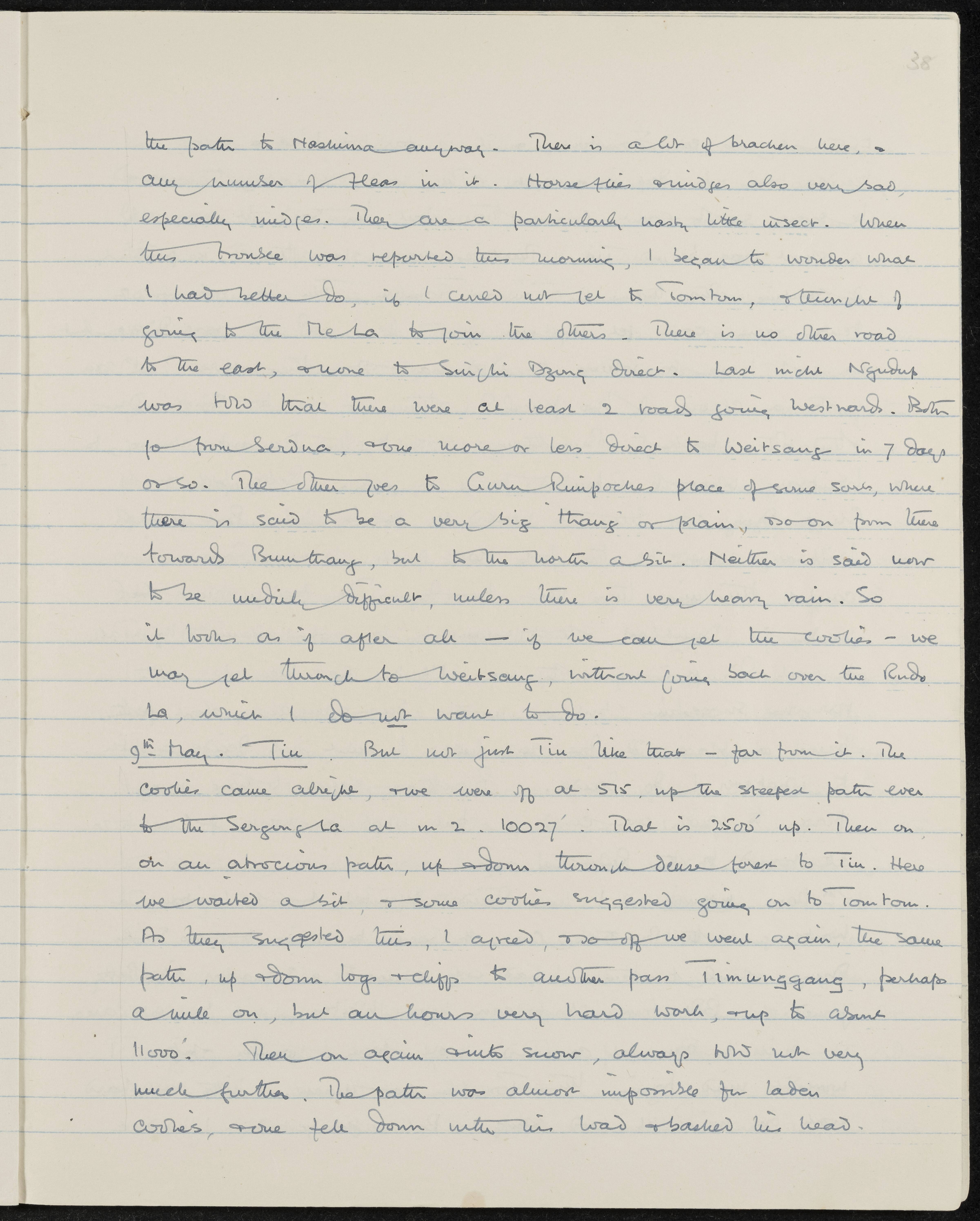
The writer considers westward routes toward Weitsang without recrossing the Rudu La, noting options from Serdua or via Guru Rinpoche's place toward Bumthang, while describing severe insect troubles. On 9th May they start early, climb to the Sergung La (10,027'), reach Tin, then push on toward Tomtom over the difficult Timunggang pass in snow, where a laden coolie falls and injures his head.
CONTENT:
the path to Tashina anyway. There is a lot of bracken here, and any number of fleas in it. Horseflies and midges also very bad, especially midges. They are a particularly nasty little insect. When this trouble was reported this morning, I began to wonder what I had better do, if I could not get to Tomtom, and thought of going to the Me La to join the others. There is no other road to the east, and none to Singhi Dzong direct. Last night Ngudup was told that there were at least 2 roads going westward. Both go from Serdua, one more or less direct to Weitsang in 7 days or so. The other goes to Guru Rinpoche's place of some sort, where there is said to be a very big 'thang' or plain, and so on from there towards Bumthang, but to the north a bit. Neither is said now to be unduly difficult, unless there is very heavy rain. So it looks as if after all — if we can get the coolies — we may get through to Weitsang, without going back over the Rudu La, which I do not want to do.
9th May. Tin. But not just Tin like that — far from it. The coolies came alright, and we were off at 5.15, up the steepest path ever to the Sergung La at 10,027'. That is 2500' up. Then on, on an atrocious path, up and down through dense forest to Tin. Here we waited a bit, and some coolies suggested going on to Tomtom. As they suggested this, I agreed, and so off we went again, the same path, up and down logs and cliffs to another pass Timunggang, perhaps a mile on, but an hour's very hard work, and up to about 11,000'. Then on again into snow, always cold but not very much further. The path was almost impossible for laden coolies, and one fell down with his load and bashed his head.
Évaluation, élimination et calendrier de conservation
Accroissements
Mode de classement
Zone des conditions d'accès et d'utilisation
Conditions d'accès
Conditions de reproduction
Langue des documents
Écriture des documents
Notes de langue et graphie
Caractéristiques matérielle et contraintes techniques
Instruments de recherche
Zone des sources complémentaires
Existence et lieu de conservation des originaux
Existence et lieu de conservation des copies
Unités de description associées
Zone des notes
Identifiant(s) alternatif(s)
Mots-clés
Mots-clés - Sujets
Mots-clés - Lieux
Mots-clés - Noms
- Ngudup (Sujet)