Área de identidad
Código de referencia
Título
Fecha(s)
- 1946-12-22 (Criação)
Nivel de descripción
Volumen y soporte
1 page
Área de contexto
Nombre del productor
Institución archivística
Historia archivística
Origen del ingreso o transferencia
Área de contenido y estructura
Alcance y contenido
SUMMARY:
Notes describe diurnal and seasonal wind patterns in the Tsangpo valley, with gentle upstream winds in early mornings and stronger downstream winds later, and increased water levels causing multiple shallow channels and sandbank issues. Observations cover downstream winds at Tsela Dzong, upstream winds in April, river breadth at Tsela in December, the influence of the Gyamda Chu valley, and seasonal changes at Yigrong Tso with winter flow extending below Chara; comparison is made with March and an entry around Feb 1st is referenced.
CONTENT:
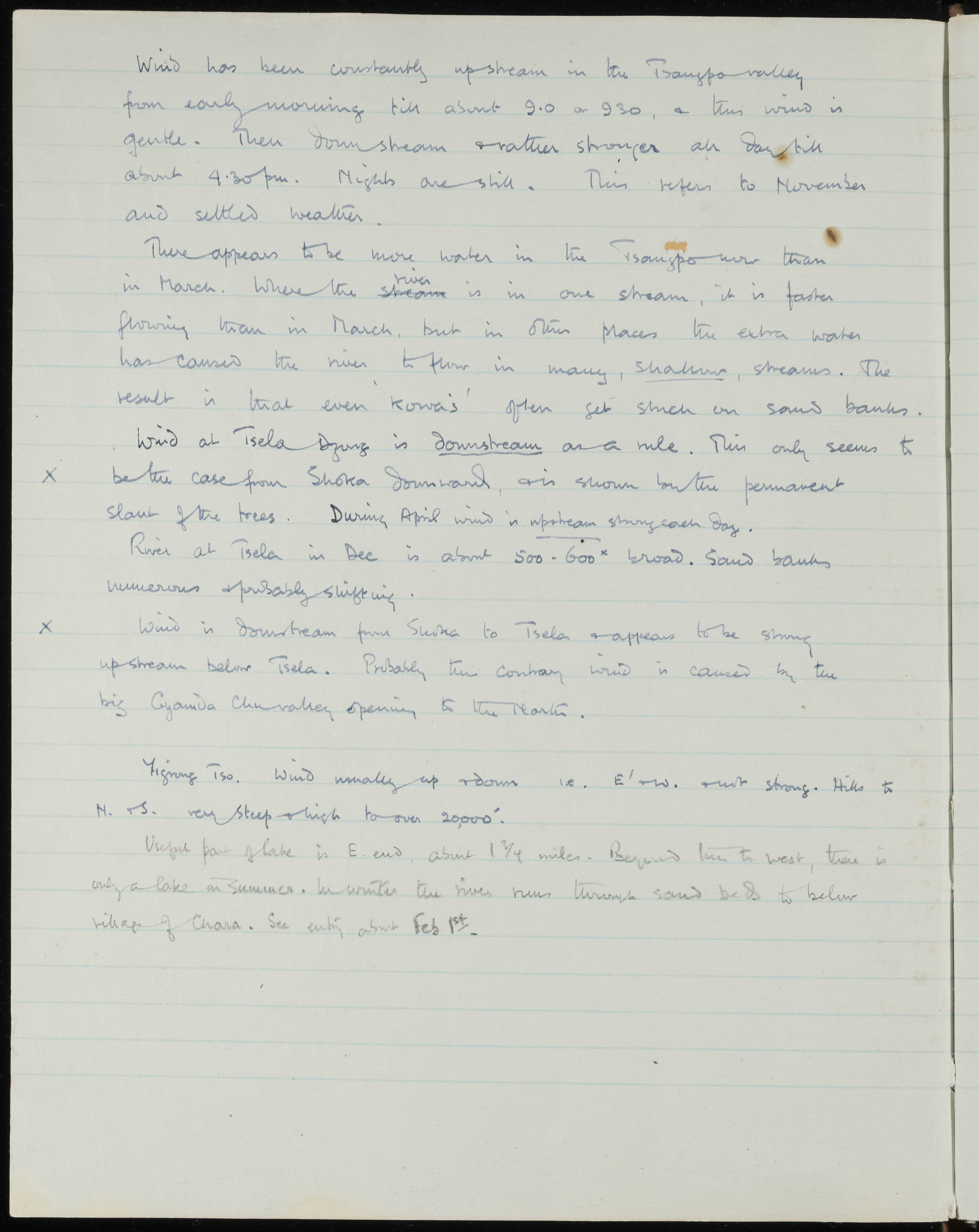
Wind has been constantly upstream in the Tsangpo valley from early morning till about 9.0 or 9.30, and this wind is gentle. Then downstream and rather stronger all day till about 4.30 pm. Nights are still. This refers to November and settled weather.
There appears to be more water in the Tsangpo now than in March. Where the river stream is in one stream, it is faster flowing than in March, but in other places the extra water has caused the river to flow in many, shallow, streams. The result is that even 'kowas' often get stuck on sand banks.
Wind at Tsela Dzong is downstream as a rule. This only seems to be the case from Shoka downward, as is shown by the permanent slant of the trees. During April wind is upstream strong each day.
River at Tsela in Dec is about 500 - 600 yds broad. Sand banks numerous and probably shifting.
Wind is downstream from Shoka to Tsela and appears to be strong upstream below Tsela. Probably the contrary wind is caused by the big Gyamda Chu valley opening to the North.
Yigrong Tso. Wind usually up and down i.e. E. and W. not strong. Hills to N. and S. very steep and high to over 20,000'.
Useful part of lake is E. end, about 1 3/4 miles. Beyond this to west, there is only a lake in summer. In winter the river runs through sand beds to below village of Chara. See entry about Feb 1st.