Identificatie
referentie code
Titel
Datum(s)
- 1949-09-13 (Vervaardig)
Beschrijvingsniveau
Omvang en medium
1 page
Context
Naam van de archiefvormer
archiefbewaarplaats
Geschiedenis van het archief
Directe bron van verwerving of overbrenging
Inhoud en structuur
Bereik en inhoud
SUMMARY:
The party crosses a high swinging bridge, climbs steeply through burnt pine forests to the Tata La, and reaches Shamgong Dz/Dzong amid clouds and afternoon thunderstorms. The next stage begins with a descent to the Wangdi Chu near the Mangde Chu, followed by a steep ascent to the Bruksong La en route to Tesar.
CONTENT:
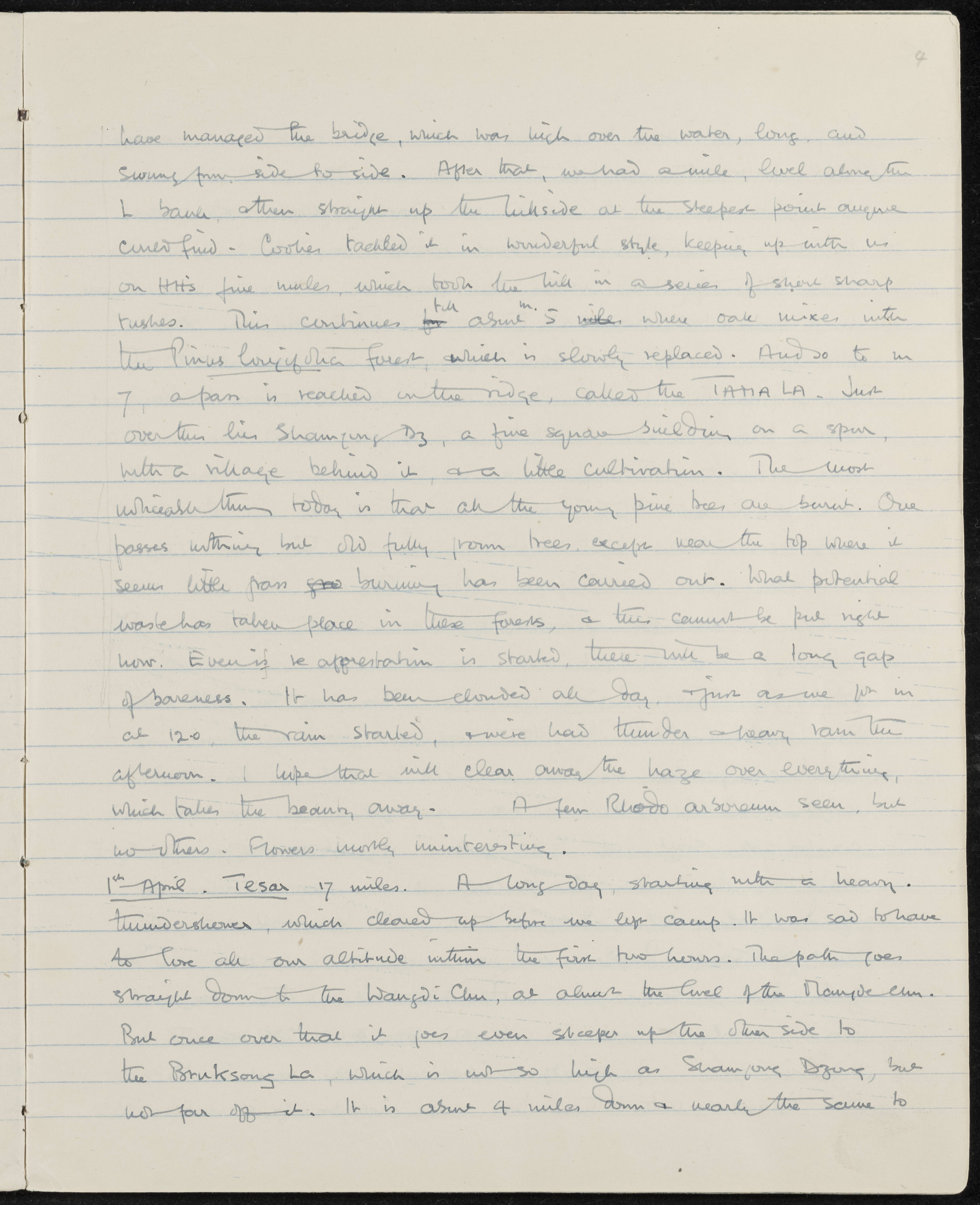
have managed the bridge, which was high over the water, long, and swung from side to side. After that, we had a mile, level along the L bank, then straight up the hillside at the steepest point anyone could find - Coolies tackled it in wonderful style, keeping up with us on H.H.'s fine mules, which took the hill in a series of short sharp rushes. This continues for about 5 miles, where oak mixes with the Pinus longifolia forest, which is slowly replaced. And so to mile 7, a pass is reached on the ridge, called the TATA LA. Just over this lies Shamgong Dz, a fine square building on a spur, with a village behind it, and a little cultivation. The most noticeable thing today is that all the young pine trees are burnt. One passes nothing but old fully grown trees, except near the top where it seems little grass burning has been carried out. What potential waste has taken place in these forests, and this cannot be put right now. Even if re-afforestation is started, there will be a long gap of bareness. It has been clouded all day, and just as we got in at 12:00 the rain started, and we've had thunder and heavy rain this afternoon. I hope that will clear away the haze over everything, which takes the beauty away. A few Rhodo arboreum seen, but no others. Flowers mostly uninteresting.
1st April. Tesar 17 miles. A long day, starting with a heavy thundershower, which cleared up before we left camp. It was sad to have to lose all our altitude within the first two hours. The path goes straight down to the Wangdi Chu, at almost the level of the Mangde Chu. But once over that it goes even steeper up the other side to the Bruksong La, which is not so high as Shamgong Dzong, but not far off it. It is about 4 miles down and nearly the same to
Waardering, vernietiging en slectie
Aanvullingen
Ordeningstelsel
Voorwaarden voor toegang en gebruik
Voorwaarden voor raadpleging
Voorwaarden voor reproductie
Taal van het materiaal
Schrift van het materiaal
Taal en schrift aantekeningen
Fysieke eigenschappen en technische eisen
Toegangen
Verwante materialen
Bestaan en verblifplaats van originelen
Bestaan en verblijfplaats van kopieën
Related units of description
Aantekeningen
Alternative identifier(s)
Trefwoorden
Onderwerp trefwoord
Geografische trefwoorden
Naam ontsluitingsterm
- H.H. (Onderwerp)
- pinus longifolia (Onderwerp)
- Rhodo arboreum (Onderwerp)