Identity area
Reference code
Title
Date(s)
- 1933-09-13 (Creation)
Level of description
Extent and medium
1 page
Context area
Name of creator
Repository
Archival history
Immediate source of acquisition or transfer
Content and structure area
Scope and content
SUMMARY:
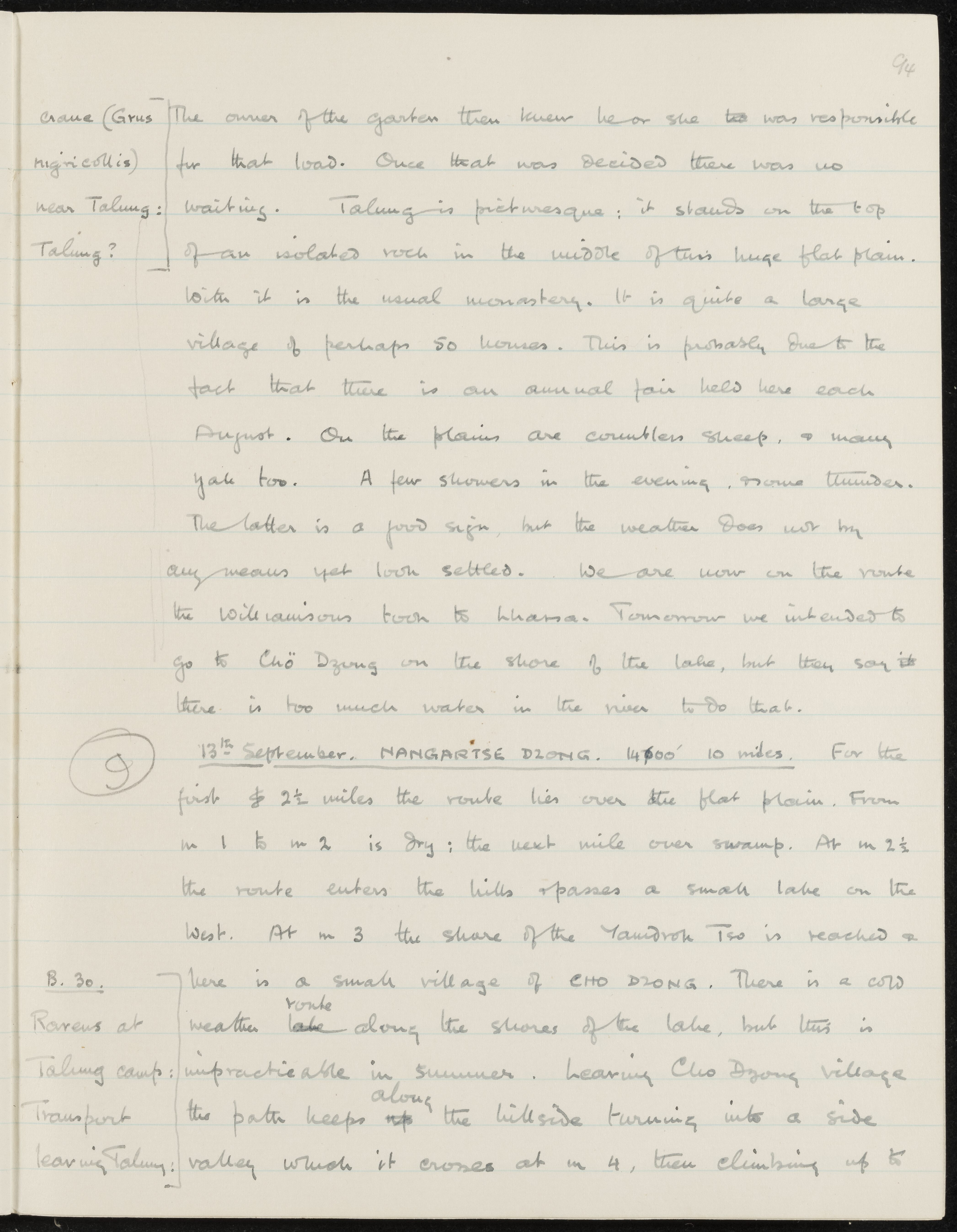
Notes a black‑necked crane near Talung and describes Talung’s monastery, village, and August fair, with showers and thunder in the evening. Describes the 13th September route toward Nangartse Dzong via Chö Dzong by Yamdrok Tso, noting high river levels preventing the lakeshore route and that the party is on the route the Williamsons took to Lhasa.
CONTENT:
94
crane (Grus nigricollis) near Talung: Talung?
The owner of the garden then knew he or she too was responsible for that load. Once that was decided there was no waiting. Talung is picturesque; it stands on the top of an isolated rock in the middle of this huge flat plain. With it is the usual monastery. It is quite a large village of perhaps 50 houses. This is probably due to the fact that there is an annual fair held here each August. On the plains are countless sheep, & many yak too. A few showers in the evening, some thunder. The latter is a good sign, but the weather does not by any means yet look settled. We are now on the route the Williamsons took to Lhasa. Tomorrow we intended to go to Chö Dzong on the shore of the lake, but they say there is too much water in the river to do that.
(9)
13th September. NANGARTSE DZONG. 14,500' 10 miles. For the first 2 1/2 miles the route lies over the flat plain. From m 1 to m 2 is dry; the next mile over swamp. At m 2 1/2 the route enters the hills & passes a small lake on the west. At m 3 the shore of the Yamdrok Tso is reached & here is a small village of CHO DZONG. There is a cold weather route along the shores of the lake, but this is impracticable in summer. Leaving Cho Dzong village the path keeps along the hillside turning into a side valley which it crosses at m 4, then climbing up to
B. 30.
Ravens at Talung camp:
Transport leaving Talung:
Appraisal, destruction and scheduling
Accruals
System of arrangement
Conditions of access and use area
Conditions governing access
Conditions governing reproduction
Language of material
Script of material
Language and script notes
Physical characteristics and technical requirements
Finding aids
Allied materials area
Existence and location of originals
Existence and location of copies
Related units of description
Notes area
Alternative identifier(s)
Access points
Subject access points
Name access points
- Williamsons (Subject)
- Grus nigricollis (Subject)