Identificatie
referentie code
Titel
Datum(s)
- 1938-10-22 (Vervaardig)
Beschrijvingsniveau
Omvang en medium
1 page
Context
Naam van de archiefvormer
archiefbewaarplaats
Geschiedenis van het archief
Directe bron van verwerving of overbrenging
Inhoud en structuur
Bereik en inhoud
SUMMARY:
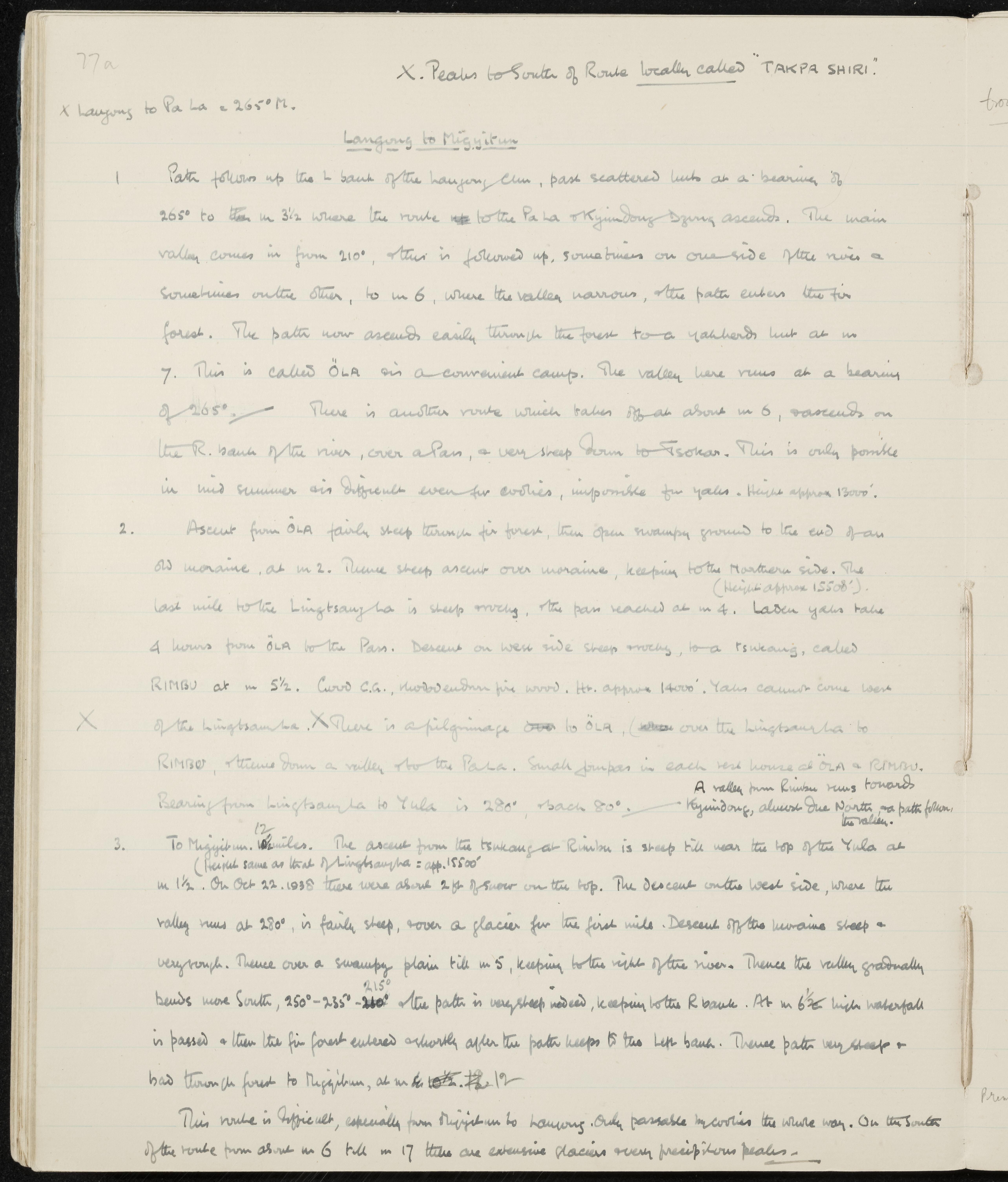
Detailed route description from Langong up the Langong Chu through Öla to the Lingtsang La, descending to Rimbu and crossing the Yula to reach Migyitun, with mileages, bearings, heights, and seasonal limitations. Notes include a difficult alternate to Tsokan, a pilgrimage route via Öla–Lingtsang La–Rimbu–Pa La, and extensive glaciers and precipitous peaks south of the route. On 22 October 1938, about two feet of snow were reported on the top.
CONTENT:
77a
X. Peaks to South of Route locally called "TAKPA SHIRI".
X Langong to Pa La = 265° M.
Langong to Migyitun
-
Path follows up the left bank of the Langong Chu, past scattered huts at a bearing of 265° to mile 3½ where the route to the Pa La and Kyindong Dzong ascends. The main valley comes in from 210°; this is followed up, sometimes on one side of the river and sometimes on the other, to mile 6, where the valley narrows and the path enters the fir forest. The path now ascends easily through the forest to a yakherd's hut at mile 7. This is called Öla and is a convenient camp. The valley here runs at a bearing of 265°. There is another route which takes off at about mile 6 and ascends on the right bank of the river, over a pass, and very steeply down to Tsokan. This is only possible in mid-summer and is difficult even for coolies, and impossible for yaks. Height approx. 13,000'.
-
Ascent from Öla is fairly steep through fir forest, then open swampy ground to the end of an old moraine at mile 2. Thence there is a steep ascent over the moraine, keeping to the northern side. The last mile to the Lingtsang La is steep and rocky; the pass is reached at mile 4 (height approx. 15,500'). Laden yaks take 4 hours from Öla to the pass. Descent on the west side is steep and rocky to a tsukang called Rimbu at mile 5½. Good camping ground, rhododendron firewood. Height approx. 14,000'. Yaks cannot come west of the Lingtsang La. There is a pilgrimage over to Öla, over the Lingtsang La to Rimbu, and thence down a valley to the Pa La. Small gompas in each rest house at Öla and Rimbu. Bearing from Lingtsang La to Yula is 280°, back 80°. A valley from Rimbu runs towards Kyindong, almost due north; no path follows the valley.
-
To Migyitun, 12 miles. The ascent from the tsukang at Rimbu is steep until near the top of the Yula at mile 1½ (height same as that of Lingtsang La, approx. 15,500'). On October 22, 1938, there were about 2 feet of snow on the top. The descent on the west side, where the valley runs at 280°, is fairly steep, over a glacier for the first mile. Descent off the moraine is steep and very rough. Thence over a swampy plain until mile 5, keeping to the right of the river. Thence the valley gradually bends more south: 250°-235°-215°. The path is very steep indeed, keeping to the right bank. At mile 6½, a high waterfall is passed, and then the fir forest is entered; shortly after, the path keeps to the left bank. Thence the path is very steep and bad through the forest to Migyitun at mile 12.
This route is difficult, especially from Migyitun to Langong. Only passable by coolies the whole way. On the south of the route from about mile 6 until mile 17, there are extensive glaciers and very precipitous peaks.