Identificatie
referentie code
Titel
Datum(s)
- 1947-02-20 (Vervaardig)
Beschrijvingsniveau
Omvang en medium
1 page
Context
Naam van de archiefvormer
archiefbewaarplaats
Geschiedenis van het archief
Directe bron van verwerving of overbrenging
Inhoud en structuur
Bereik en inhoud
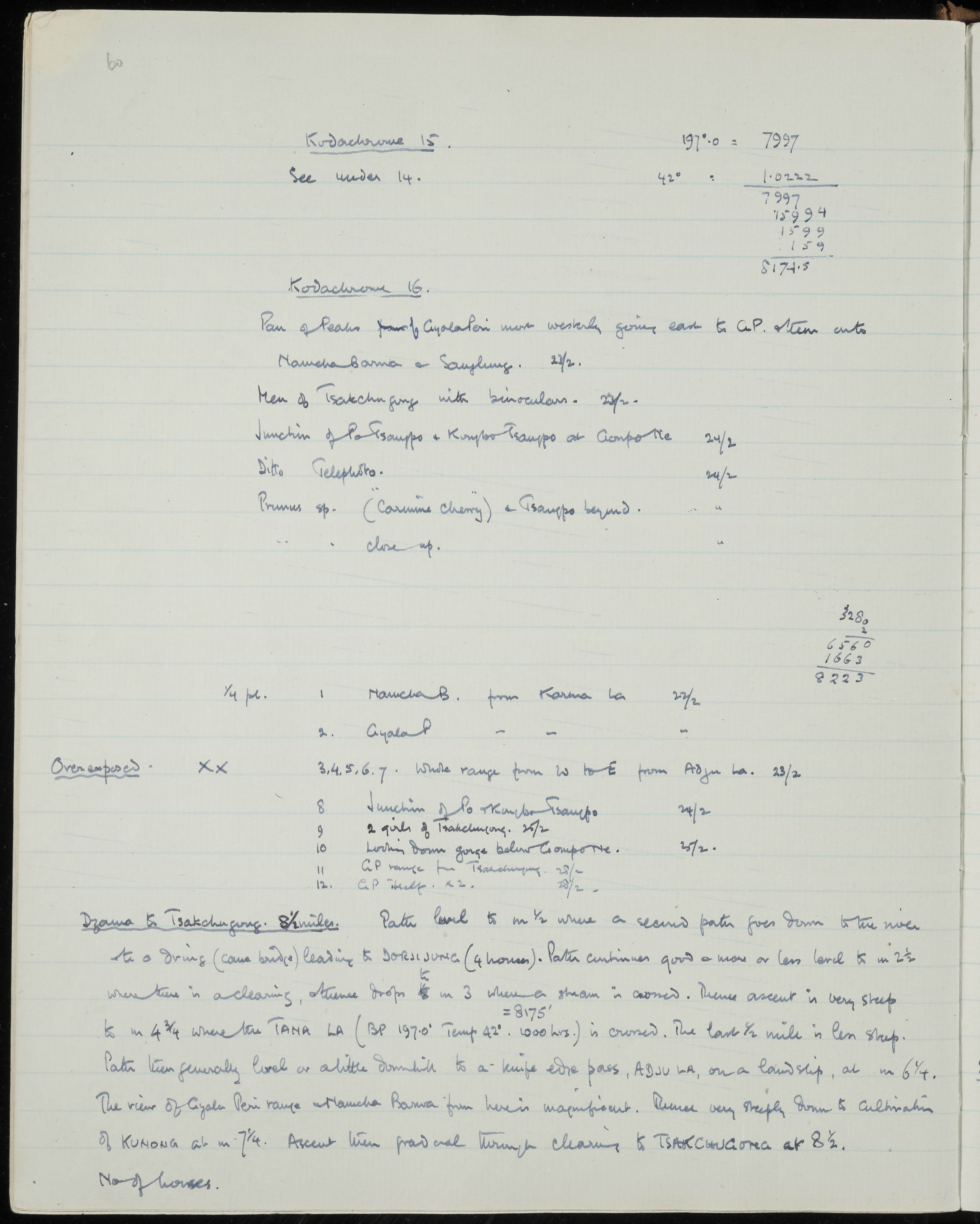
SUMMARY:
The page lists Kodachrome photo subjects around Gyala Peri, Namcha Barwa, Sanglung, and the junction of the Po and Kongbo Tsangpo near Gompo Ne, including scenes and local people at Tsakchungong. It also describes the route from Dzama to Tsakchungong with distances, passes (Tana La, Adju La), a cane bridge to Dorji Jung, gradients, and elevations, noting a magnificent view of the Gyala Peri range and Namcha Barwa.
CONTENT:
60
Kodachrome 15. 197.0 = 7997
See under 14. 42° : 1.0222
7997
15994
1599
159
8174.5
Kodachrome 16.
Pan of peaks from Gyala Peri most westerly going east to G.P. then onto
Namcha Barwa & Sanglung. 22/2.
Men of Tsakchungong with binoculars. 22/2.
Junction of Po Tsangpo & Kongbo Tsangpo at Gompo Ne 24/2
Ditto Telephoto. 24/2
Prunus sp. ("Carmine Cherry") & Tsangpo beyond. "
" close up. "
3280
2
6560
1663
8223
1/4 pl. 1 Namcha B. from Karma La 22/2
2 Gyala P. " " "
Overexposed. XX 3, 4, 5, 6, 7. Whole range from W to E from Adju La. 23/2
8 Junction of Po & Kongbo Tsangpo 24/2
9 2 girls of Tsakchungong. 25/2
10 Looking down gorge below Gompo Ne. 25/2.
11 G.P. range from Tsakchungong. 25/2
12 G.P. " x 2. 25/2
Dzama to Tsakchungong. 8 1/2 miles. Path level to m 1/2 where a second path goes down to the river to a dring (cane bridge) leading to DORJI JUNG (4 houses). Path continues good & more or less level to m 2 1/2 where there is a clearing, thence drops to m 3 where a stream is crossed. Thence ascent is very steep = 8175' to m 4 3/4 where the TANA LA (BP 197.0° Temp 42°. 1000 hrs.) is crossed. The last 1/2 mile is less steep. Path then generally level or a little downhill to a knife edge pass, ADJU LA, on a landslip, at m 6 1/4. The view of Gyala Peri range & Namcha Barwa from here is magnificent. Runs very steeply down to cultivation of KUNONG at m 7 1/4. Ascent then gradual through clearing to TSAKCHUNGONG at 8 1/2.
No of houses.
Waardering, vernietiging en slectie
Aanvullingen
Ordeningstelsel
Voorwaarden voor toegang en gebruik
Voorwaarden voor raadpleging
Voorwaarden voor reproductie
Taal van het materiaal
Schrift van het materiaal
Taal en schrift aantekeningen
Fysieke eigenschappen en technische eisen
Toegangen
Verwante materialen
Bestaan en verblifplaats van originelen
Bestaan en verblijfplaats van kopieën
Related units of description
Aantekeningen
Alternative identifier(s)
Trefwoorden
Onderwerp trefwoord
Geografische trefwoorden
Naam ontsluitingsterm
- Prunus sp. (Onderwerp)