Área de identidad
Código de referencia
Título
Fecha(s)
- 1933-09-05 (Criação)
Nivel de descripción
Volumen y soporte
1 page
Área de contexto
Nombre del productor
Institución archivística
Historia archivística
Origen del ingreso o transferencia
Área de contenido y estructura
Alcance y contenido
SUMMARY:
Route notes from Mug to Singhi Dzong and onward to Towa Dzong, detailing ascents, bridges over the Lhobrak/Kuru Chu, and the crossing of Nyema La (14800'). Mentions transport changes at a village and Lala, and notes camp near the new Dzong with good water and fuel.
CONTENT:
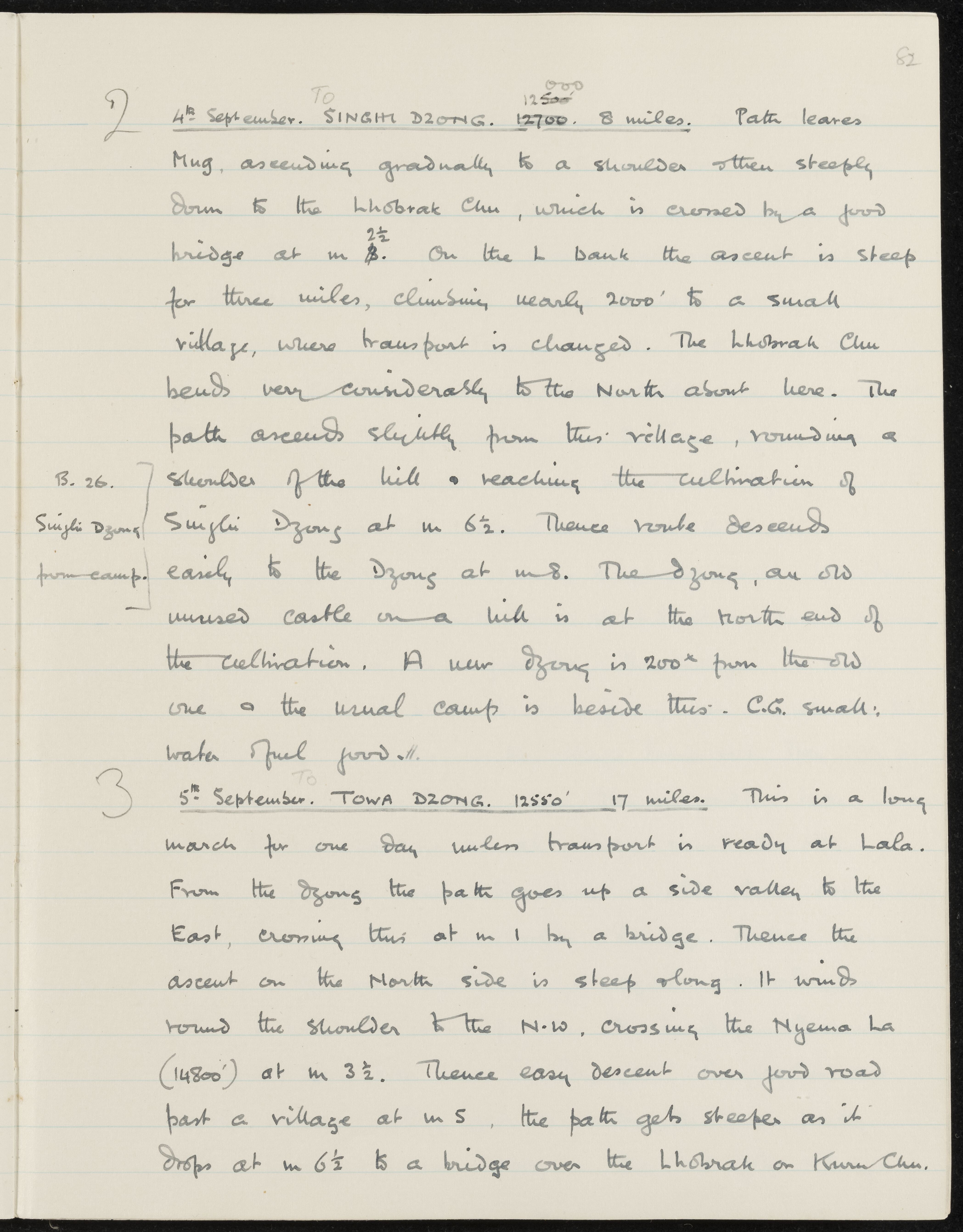
2 4th September. To SINGHI DZONG. 12700. 8 miles. Path leaves
Mug, ascending gradually to a shoulder then steeply
down to the Lhobrak Chu, which is crossed by a good
bridge at m 2 1/2. On the L bank the ascent is steep
for three miles, climbing nearly 2000' to a small
village, where transport is changed. The Lhobrak Chu
bends very considerably to the North about here. The
path ascends slightly from this village, rounding a
shoulder of the hill & reaching the cultivation of
Singhi Dzong at m 6 1/2. Thence route descends
easily to the Dzong at m 8. The Dzong, an old
unused castle on a hill is at the North end of
the cultivation. A new Dzong is 200 yds from the old
one & the usual camp is beside this. C.G. small:
water & fuel good.
3 5th September. To TOWA DZONG. 12550' 17 miles. This is a long
march for one day unless transport is ready at Lala.
From the Dzong the path goes up a side valley to the
East, crossing this at m 1 by a bridge. Thence the
ascent on the North side is steep along. It winds
round the shoulder to the N.W., crossing the Nyema La
(14800') at m 3 1/2. Thence easy descent over good road
past a village at m 5, the path gets steeper as it
drops at m 6 1/2 to a bridge over the Lhobrak or Kuru Chu.