Área de identidad
Código de referencia
Título
Fecha(s)
- 1933-07-04 (Criação)
Nivel de descripción
Volumen y soporte
1 page
Área de contexto
Nombre del productor
Institución archivística
Historia archivística
Origen del ingreso o transferencia
Área de contenido y estructura
Alcance y contenido
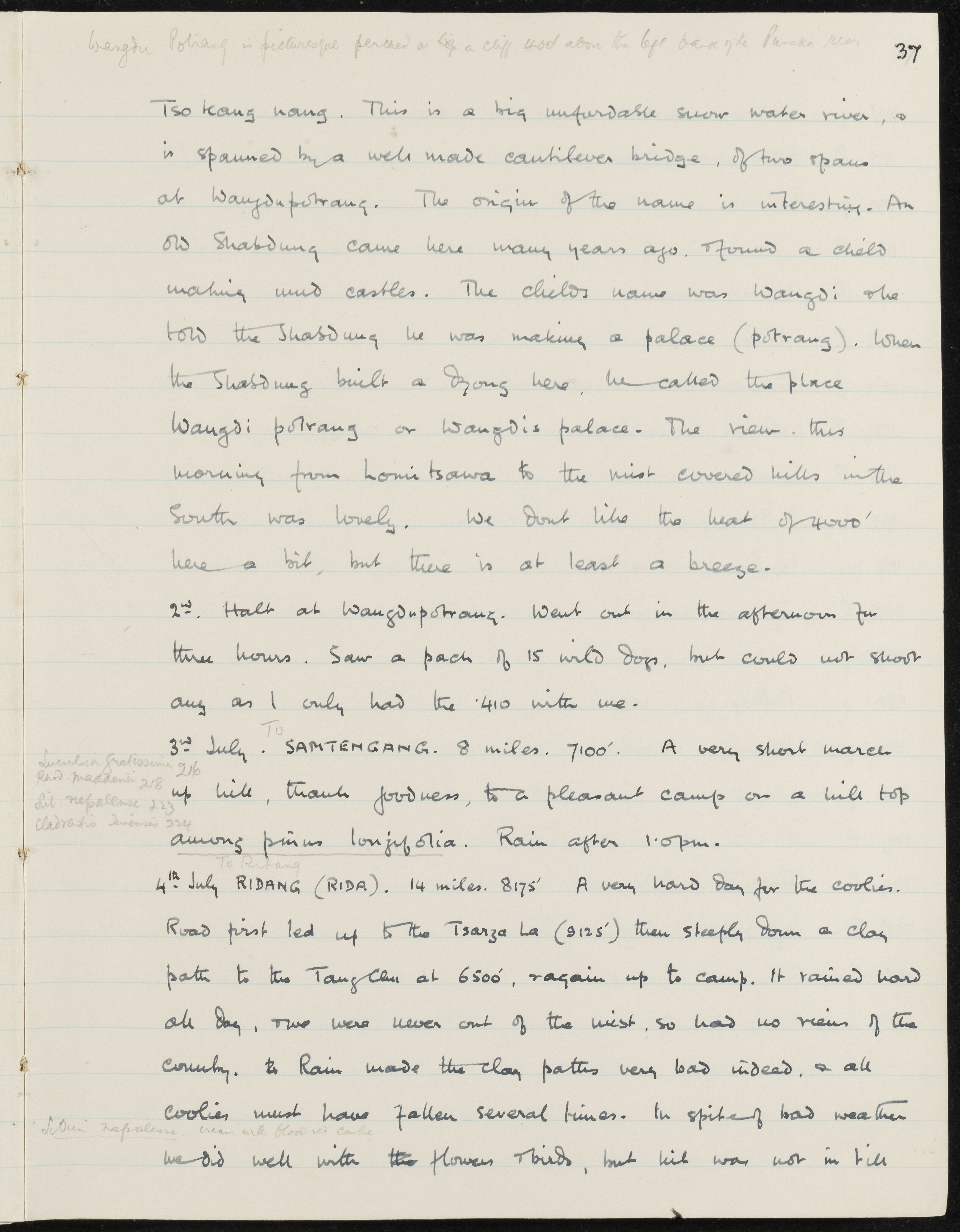
SUMMARY:
Describes Wangdu Potrang above the Punaka river and the Tso Kang Nang, including an etymology of 'Wangdi potrang'. Records a halt at Wangdupotrang with a sighting of wild dogs, then marches to Samtengang and Ridang via Tsarza La and Tangchu in heavy rain, with notes on altitudes and plant collections.
CONTENT:
Wangdu Potrang is picturesque perched on a cliff 400' above the left bank of the Punaka river.
Tso Kang Nang. This is a big unfordable snow water river, & is spanned by a well made cantilever bridge, of two spans at Wangdupotrang. The origin of the name is interesting. An old Shabdrung came here many years ago, & found a child making mud castles. The child's name was Wangdi who told the Shabdrung he was making a palace (potrang). When the Shabdrung built a Dzong here, he called the place Wangdi potrang or Wangdi's palace. The view this morning from Lomitsawa to the mist covered hills in the South was lovely. We don't like the heat of 4000' here a bit, but there is at least a breeze.
2nd. Halt at Wangdupotrang. Went out in the afternoon for three hours. Saw a pack of 15 wild dogs, but could not shoot any as I only had the .410 with me.
3rd July. To SAMTENGANG. 8 miles. 7100'. A very short march up hill, thank goodness, to a pleasant camp on a hill top among pinus longifolia. Rain after 1.0pm.
Luculia gratissima 216
Rhod. maddenii 218
Lil. nepalense 223
Cladrastis sinensis 224
4th July. To RIDANG (RIDA). 14 miles. 8175'. A very hard day for the coolies. Road first led up to the Tsarza La (9125') then steeply down a clay path to the Tangchu at 6500', & again up to camp. It rained hard all day, & we were never out of the mist, so had no views of the country. The Rain made the clay paths very bad indeed, & all coolies must have fallen several times. In spite of bad weather we did well with the flowers & birds, but luck was not in till
Lilium nepalense. cream with blood red centre
Valorización, destrucción y programación
Acumulaciones
Sistema de arreglo
Área de condiciones de acceso y uso
Condiciones de acceso
Condiciones
Idioma del material
Escritura del material
Notas sobre las lenguas y escrituras
Características físicas y requisitos técnicos
Instrumentos de descripción
Área de materiales relacionados
Existencia y localización de originales
Existencia y localización de copias
Unidades de descripción relacionadas
Área de notas
Identificador/es alternativo(os)
Puntos de acceso
Puntos de acceso por materia
Puntos de acceso por lugar
Puntos de acceso por autoridad
- Shabdrung (Materia)
- Wangdi (Materia)
- Cladrastis sinensis (Materia)
- Lilium nepalense (Materia)
- Luculia gratissima (Materia)
- pinus longifolia (Materia)
- Rhod. maddenii (Materia)