Zona de identificação
Código de referência
Título
Data(s)
- 1933-07-08 (Produção)
Nível de descrição
Dimensão e suporte
1 page
Zona do contexto
Nome do produtor
Entidade detentora
História do arquivo
Fonte imediata de aquisição ou transferência
Zona do conteúdo e estrutura
Âmbito e conteúdo
SUMMARY:
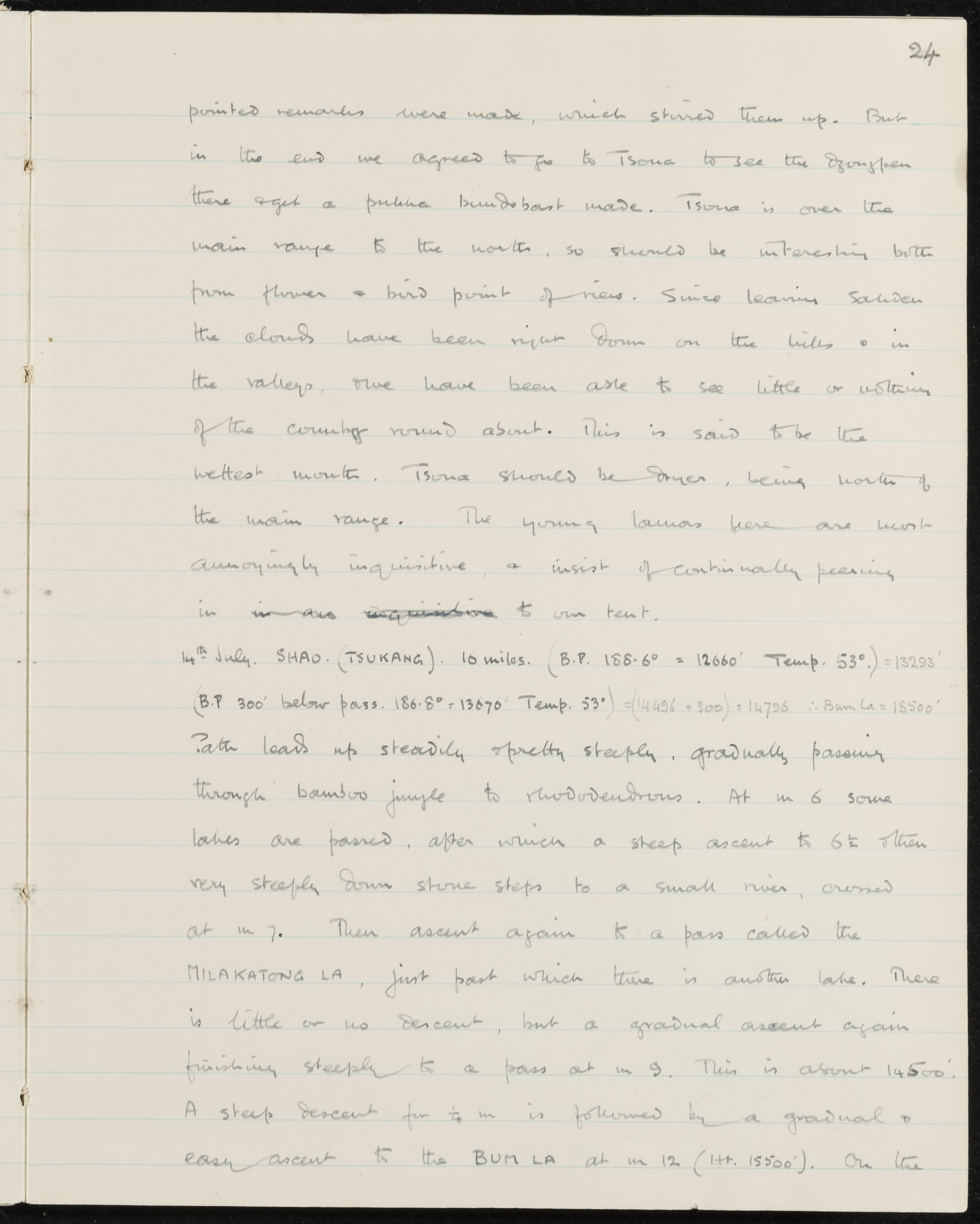
The party plans to go to Tsona to see the Dzongpen for formal arrangements, noting poor visibility and wet conditions since leaving Sakden but expecting drier weather north of the main range. Young lamas are described as persistently inquisitive. The entry details the 10-mile route to Shao (Tsukang), passing lakes and ascending via the Milakatong La and Bum La passes with noted elevations.
CONTENT:
24
pointed remarks were made, which stirred them up. But in the end we agreed to go to Tsona to see the Dzongpen there and get a pukka bundobast made. Tsona is over the main range to the north, so should be interesting both from flower and bird point of view. Since leaving Sakden the clouds have been right down on the hills and in the valleys, and we have been able to see little or nothing of the country round about. This is said to be the wettest month. Tsona should be drier, being north of the main range. The young lamas here are most annoyingly inquisitive, and insist on continually peering into our tent.
14th July. SHAO. (TSUKANG). 10 miles. (B.P. 188.6° = 12660' Temp. 53°.) = 13293'
(B.P 300' below pass. 186.8° = 13670' Temp. 53°) = (14496 + 300) = 14796 ∴ Bum La = 15500'
Path leads up steadily and pretty steeply, gradually passing through bamboo jungle to rhododendrons. At m 6 some lakes are passed, after which a steep ascent to 6½ and then very steeply down stone steps to a small river, crossed at m 7. Then ascent again to a pass called the MILAKATONG LA, just past which there is another lake. There is little or no descent, but a gradual ascent again finishing steeply to a pass at m 9. This is about 14500'. A steep descent for ½ m is followed by a gradual and easy ascent to the BUM LA at m 12 (Ht. 15500'). On the
Avaliação, seleção e eliminação
Incorporações
Sistema de arranjo
Zona de condições de acesso e utilização
Condições de acesso
Condiçoes de reprodução
Idioma do material
Sistema de escrita do material
Notas ao idioma e script
Características físicas e requisitos técnicos
Instrumentos de descrição
Zona de documentação associada
Existência e localização de originais
Existência e localização de cópias
Unidades de descrição relacionadas
Zona das notas
Identificador(es) alternativo(s)
Pontos de acesso
Pontos de acesso - Assuntos
Pontos de acesso - Locais
Pontos de acesso - Nomes
- Dzongpen (Assunto)
- young lamas (Assunto)