Área de identidad
Código de referencia
Título
Fecha(s)
- 1983-05-05 (Criação)
Nivel de descripción
Volumen y soporte
1 page
Área de contexto
Nombre del productor
Institución archivística
Historia archivística
Origen del ingreso o transferencia
Área de contenido y estructura
Alcance y contenido
SUMMARY:
Route directions describe a descent from a second pass to Tahtsang RH, then a steep climb to the Sha ngu La with an alternate road to Chienchao, followed by a descent to a bridge leading to Somtsang. Additional notes cover Yüto to Chakta Trang and on to the Kankyu La, with details on forested sections, stream crossings, and rough road conditions.
CONTENT:
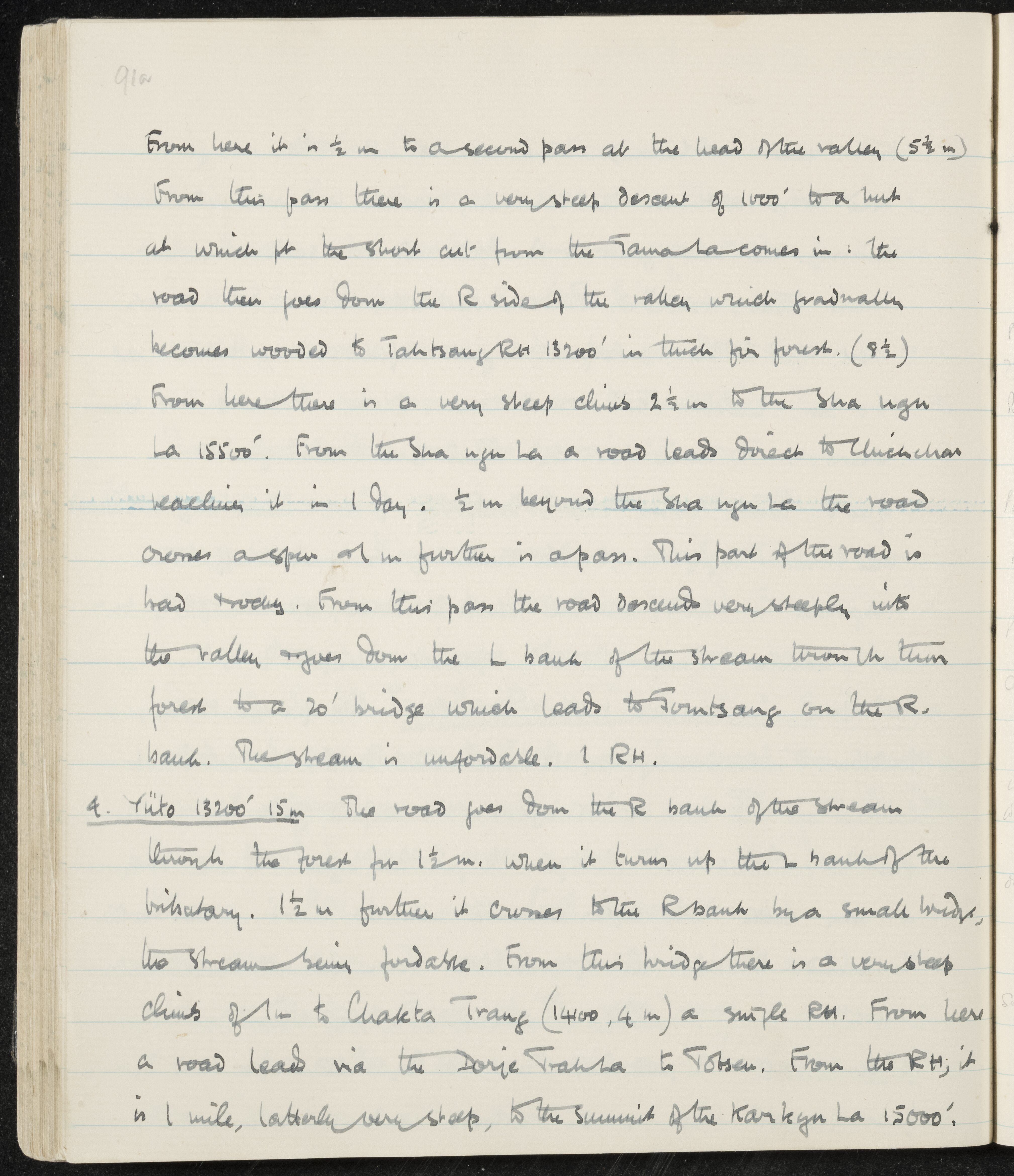
From here it is 1/2 m to a second pass at the head of the valley (5 1/2 m). From this pass there is a very steep descent of 1000' to a link at which pt the short cut from the Tama La comes in. The road then goes down the R side of the valley which gradually becomes wooded to Tahtsang RH 13200' in thick fir forest. (9 1/2)
From here there is a very steep climb 2 1/2 m to the Sha ngu La 15500'. From the Sha ngu La a road leads direct to Chienchao reaching it in 1 day. 1/2 m beyond the Sha ngu La the road crosses a spur & 1 m further is a pass. This part of the road is bad & rocky. From this pass the road descends very steeply into the valley & goes down the L bank of the stream through thin forest to a 20' bridge which leads to Somtsang on the R. bank. The stream is unfordable. 1 RH.
- Yüto 13200' 15m The road goes down the R bank of the stream through the forest for 1 1/2 m. when it turns up the L bank of the tributary. 1 1/2 m further it crosses to the R bank by a small bridge, the stream being fordable. From this bridge there is a very steep climb of 1 m to Chakta Trang (14100, 4 m) a single RH. From here a road leads via the Dorje Trahsa to Totsen. From the RH, it is 1 mile, latterly very steep, to the summit of the Kankyu La 15000'.