Zone d'identification
Cote
GB 235 LSH/1/1/2/1/128
Titre
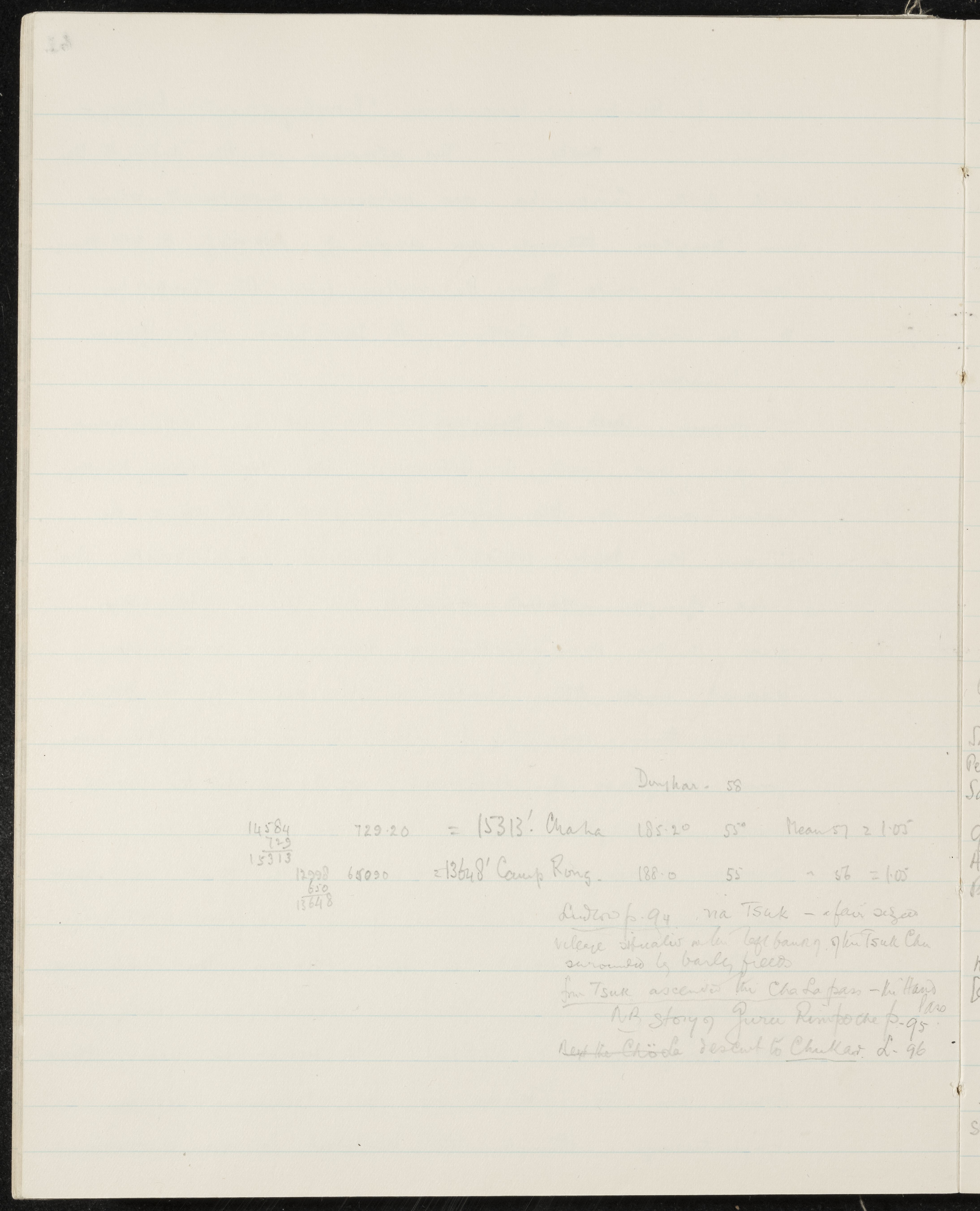
Route notes from Tsuk over Cha La pass to Chukar, with altitude calculations
Date(s)
- 1933-07-18 (Production)
Niveau de description
Part
Étendue matérielle et support
1 page
Zone du contexte
Nom du producteur
(1898-1967)
Histoire archivistique
Source immédiate d'acquisition ou de transfert
Zone du contenu et de la structure
Portée et contenu
SUMMARY:
The page records altitude calculations for Cha La and Camp Rong, and notes on Tsuk village on the left bank of the Tsuk Chu. It mentions ascending the Cha La pass, passing the Chöde, and descending to Chukar, with a reference to a story of Guru Rinpoche.
CONTENT:
18
Dunkar - 58
14584 729.20 = 15313' Chala 185.20 55° Mean of 2 1.05
729
15313
12998 650.90 = 13648' Camp Rong. 188.0 55 " = 56 = 1.05
650
13648
Ludlow p. 94 na Tsuk - a fair sized
village situated on the left bank of the Tsuk Chu
surrounded by barley fields.
From Tsuk ascended the Cha La pass - the highest pass.
N.B. story of Guru Rinpoche p. 95.
Past the Chöde descent to Chukar. L. 96.