Identity area
Reference code
Title
Date(s)
- 1933-07-05 (Creation)
Level of description
Extent and medium
1 page
Context area
Name of creator
Repository
Archival history
Immediate source of acquisition or transfer
Content and structure area
Scope and content
SUMMARY:
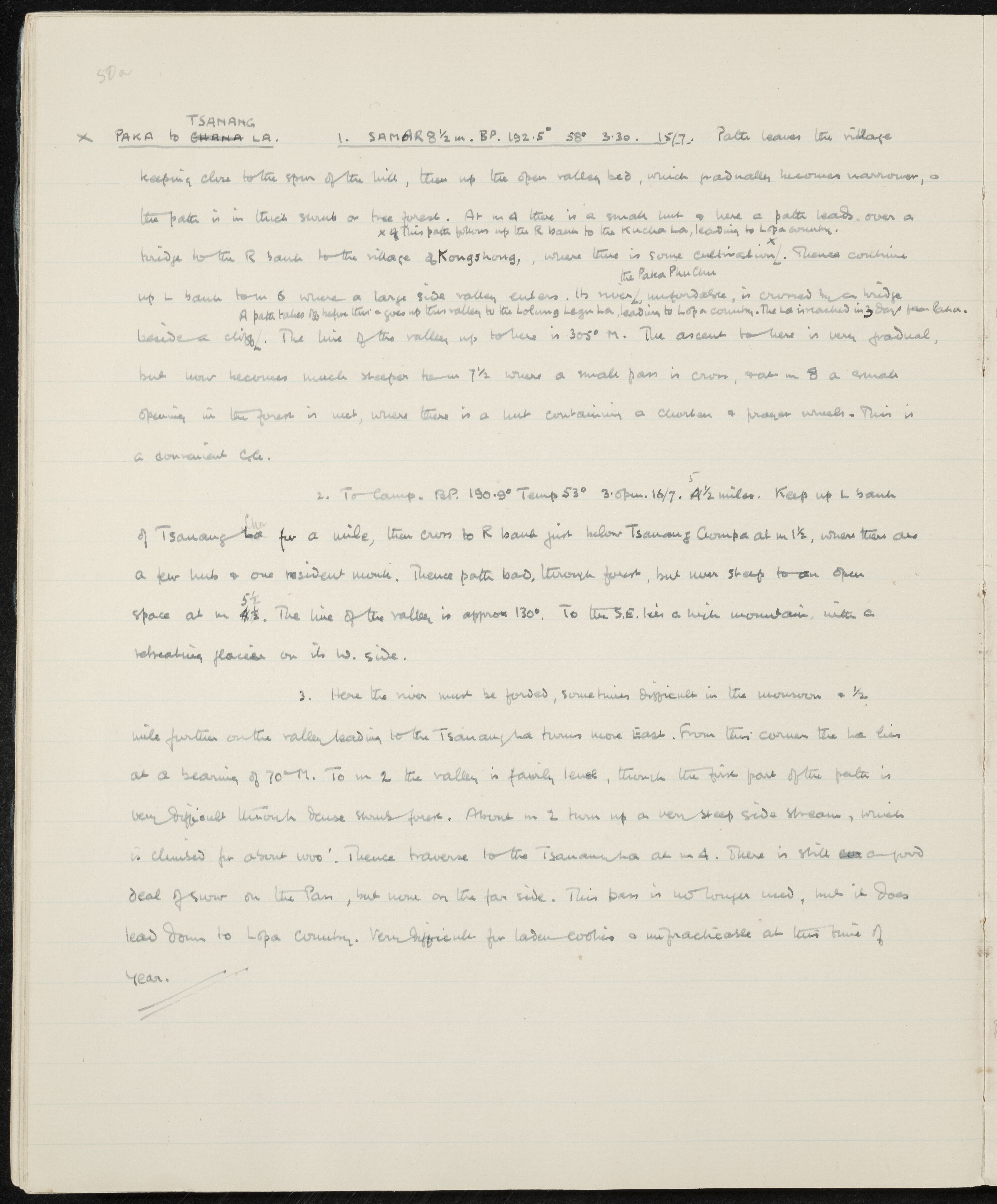
Stage notes detail travel from Paka toward Ghana La, with crossings near Kongshong and the Paka Phuchu, side routes to Kucha La and Lohung Legu La into Lopa country, and a camp by a hut with a chorten and prayer wheels. Subsequent notes cover progress along the Tsanang Chu past Tsanang Gompa, a difficult ford in the monsoon, and a steep ascent to a disused pass considered impracticable for laden coolies at this season.
CONTENT:
50a
TSANANG
PAKA to GHANA LA. 1. SAMAR 8 1/2 m. BP. 192.5° 58° 3.30. 15/7. Path leaves the village keeping close to the spur of the hill, then up the open valley bed, which gradually becomes narrower, and the path is in thick scrub or tree forest. At m 4 there is a small hut & here a path leads over a bridge to the R bank to the village of Kongshong, where there is some cultivation. (A branch of this path follows up the R bank to the Kucha La, leading to Lopa country.) Thence continue up L bank to m 6 where a large side valley enters. Its river (the Paka Phuchu), unfordable, is crossed by a bridge beside a cliff. (A path takes off before this & goes up this valley to the Lohung Legu La leading to Lopa country. The La is reached in 3 days from Paka.) The line of the valley up to here is 305° M. The ascent to here is very gradual, but now becomes much steeper to m 7 1/2 where a small pass is crossed, and at m 8 a small opening in the forest is met, where there is a hut containing a chorten & prayer wheels. This is a convenient camp.
-
To Camp. BP. 130.9° Temp 53° 3.0pm. 16/7. 4 1/2 miles. Keep up L bank of Tsanang Chu for a mile, then cross to R bank just below Tsanang Gompa at m 1 1/2, where there are a few huts & one resident monk. Thence path bad, through forest, but never steep to an open space at m 5 1/2. The line of the valley is approx 130°. To the S.E. lies a high mountain, with a retreating glacier on its W. side.
-
Here the river must be forded, sometimes difficult in the monsoon. 1/2 mile further on the valley leading to the Tsanang Chu turns more East. From this corner the La lies at a bearing of 70° M. To m 2 the valley is fairly level, though the first part of the path is very difficult through dense shrub forest. Above m 2 turn up a very steep side stream, which is climbed for about 1000'. Thence traverse to the Tsanang Chu at m 4. There is still a good deal of snow on the Pass, but none on the far side. This pass is no longer used, but it does lead down to Lopa Country. Very difficult for laden coolies & impracticable at this time of year.