Zone d'identification
Cote
Titre
Date(s)
- 1933-08-04 (Production)
Niveau de description
Étendue matérielle et support
1 page
Zone du contexte
Nom du producteur
Histoire archivistique
Source immédiate d'acquisition ou de transfert
Zone du contenu et de la structure
Portée et contenu
- SUMMARY:
Describes the route from Shingbe up to the Me La (c. 16,000 ft), noting terrain from fir forest to open grassland and the descent beyond into an open valley along a river. Discusses uncertain boundary markers (Me La, a river beyond, or the higher Cho La 15–20 miles further) and mentions Tibetans with yaks, fair grazing, and high ice-covered mountains; notes fine weather until 3 pm and a 6 am departure.
CONTENT:
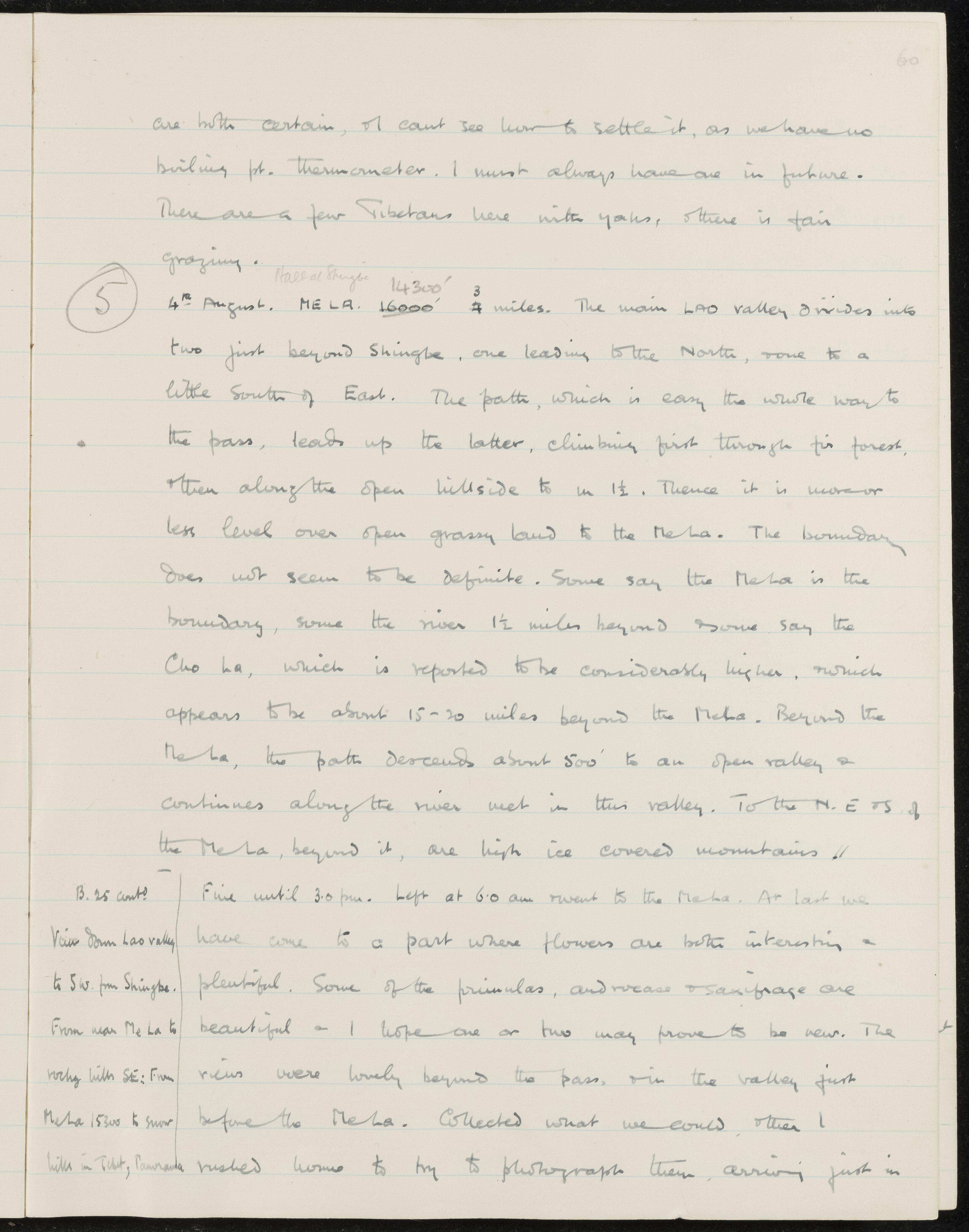
are both certain, I can't see how to settle it, as we have no
boiling pt. thermometer. I must always have one in future.
There are a few Tibetans here with yaks, and there is fair
grazing.
5 4th August. ME LA. 16000' (Pass at Shingbe 14300') 3/4 miles. The main LAO valley divides into
two just beyond Shingbe, one leading to the North, one to a
little South of East. The path, which is easy the whole way to
the pass, leads up the latter, climbing first through fir forest,
then along the open hillside for 1 1/2. Thence it is more or
less level over open grassy land to the Me La. The boundary
does not seem to be definite. Some say the Me La is the
boundary, some the river 1 1/2 miles beyond and some say the
Cho La, which is reported to be considerably higher, and which
appears to be about 15-20 miles beyond the Me La. Beyond the
Me La, the path descends about 500' to an open valley and
continues along the river met in this valley. To the N. E. and S. of
the Me La, and beyond it, are high ice covered mountains //
B. 25 contd
- Fine until 3.0 pm. Left at 6.0 am and went to the