Identity area
Reference code
Title
Date(s)
- 1937-05-29 - 1937-05-28 (Creation)
Level of description
Extent and medium
1 page
Context area
Name of creator
Repository
Archival history
Immediate source of acquisition or transfer
Content and structure area
Scope and content
SUMMARY:
Route description from a village in Phobshikha along the right bank of the Mara Chu, descending past side valleys and waterfalls to Trashi La and rejoining the river. Notes include heights with times and dates, and the route continues to Adao at mile 12, with the Mara Chu flowing toward the Wangdipotrang Chu.
CONTENT:
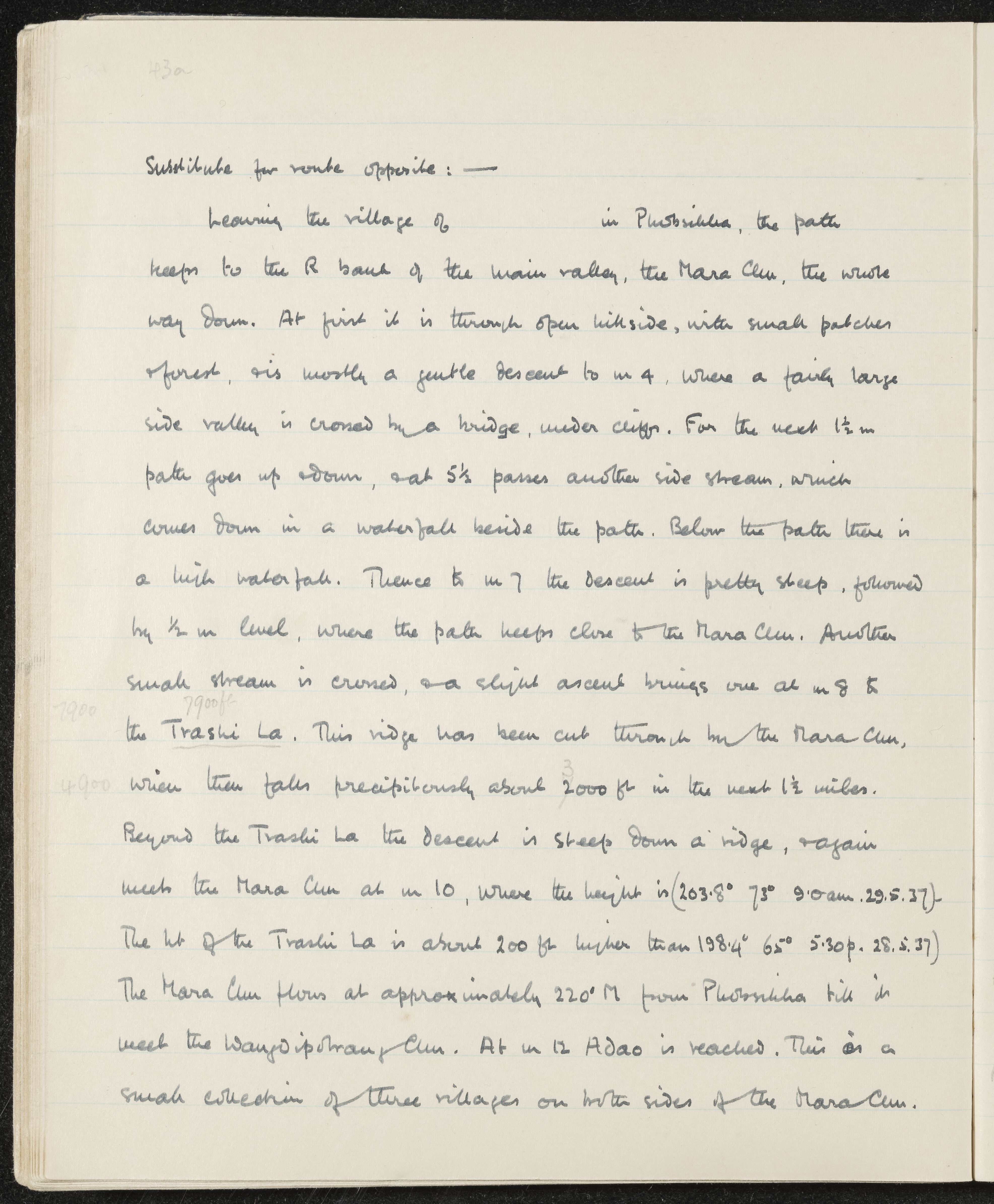
Substitute for route opposite: —
Leaving the village of [blank] in Phobshikha, the path keeps to the right bank of the main valley, the Mara Chu, the whole way down. At first it is through open hillside, with small patches of forest, and is mostly a gentle descent to mile 4, where a fairly large side valley is crossed by a bridge, under cliffs. For the next 1½ miles the path goes up and down, and at 5½ passes another side stream, which comes down in a waterfall beside the path. Below the path there is a high waterfall. Thence to mile 7 the descent is pretty steep, followed by ½ mile level, where the path keeps close to the Mara Chu. Another small stream is crossed, and a slight ascent brings one at mile 8 to the Trashi La. This ridge has been cut through by the Mara Chu, which then falls precipitously about 3000 ft in the next 1½ miles.
Beyond the Trashi La the descent is steep down a ridge, and again meets the Mara Chu at mile 10, where the height is (203.8° 73° 9.0 am. 29.5.37). The height of the Trashi La is about 200 ft higher than 198.4° 65° 5.30 pm 28.5.37. The Mara Chu flows at approximately 220° M from Phobshikha till it meets the Wangdipotrang Chu. At mile 12 Adao is reached. This is a small collection of three villages on both sides of the Mara Chu.