Área de identidad
Código de referencia
Título
Fecha(s)
- 1933-05-09 (Criação)
Nivel de descripción
Volumen y soporte
1 page
Área de contexto
Nombre del productor
Institución archivística
Historia archivística
Origen del ingreso o transferencia
Área de contenido y estructura
Alcance y contenido
SUMMARY:
The diary describes travel along the Mangde Chu with a cantilever bridge leading to Langti, Yundruchöling, and Beling, noting Ashe Paldon's old winter residence and nearby pinus forest. Observations include absence of a small iris seen previously, many monkeys feeding in a large tree, effects of grass burning on regeneration, river suitability, and mapping inaccuracies, with the route leaving Bashaling toward Kiji La.
CONTENT:
23
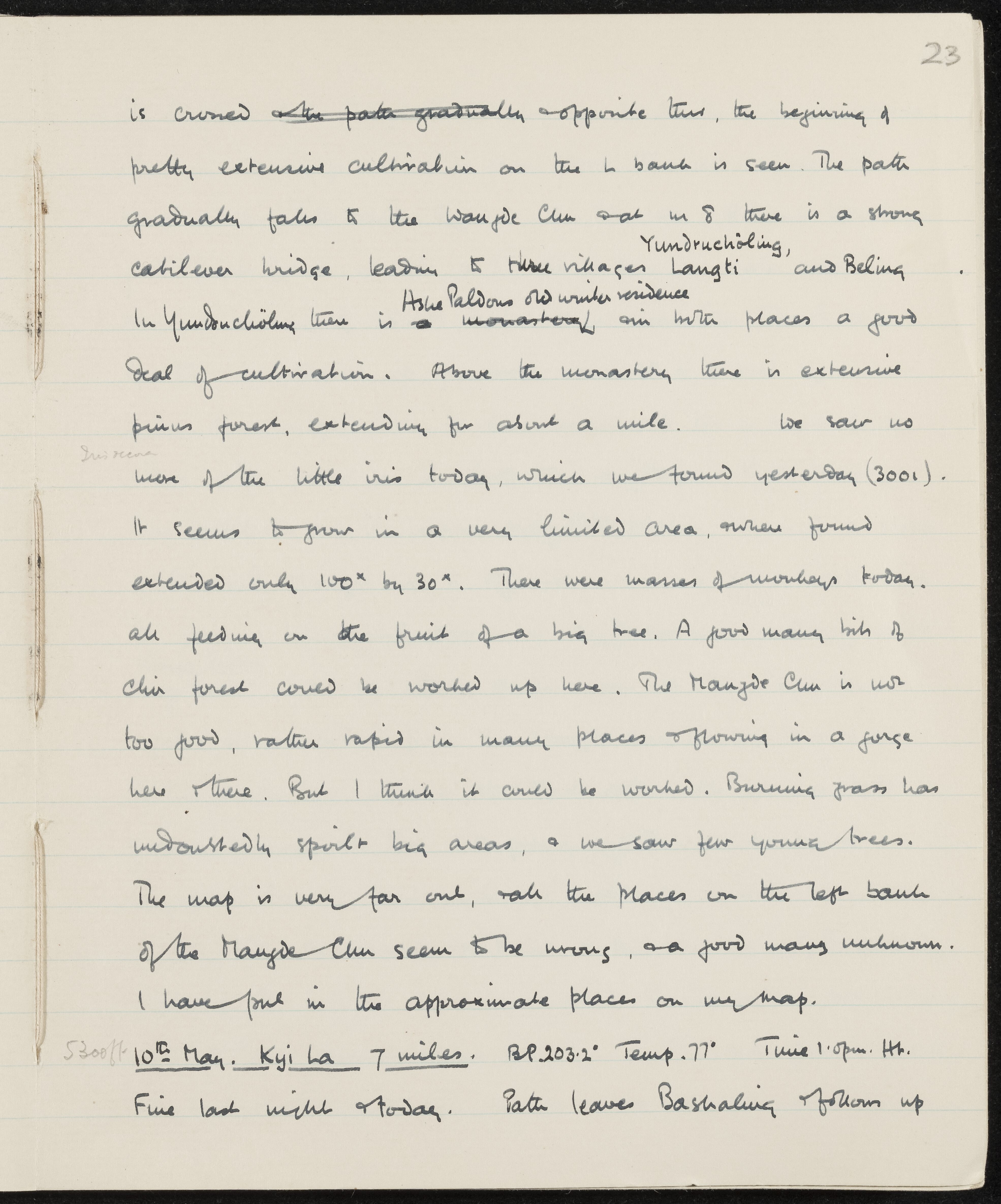
is crossed opposite this, the beginning of pretty extensive cultivation on the left bank is seen. The path gradually falls to the Mangde Chu at mile 8 there is a strong cantilever bridge, leading to three villages Langti, Yundruchöling, and Beling. In Yundruchöling there is Ashe Paldon's old winter residence and in both places a good deal of cultivation. Above the monastery there is extensive pinus forest, extending for about a mile. We saw no more of the little iris today, which we found yesterday (3001). It seems to grow in a very limited area, where found extended only 100 by 30. There were masses of monkeys today, all feeding on the fruit of a big tree. A good many bits of chir forest could be worked up here. The Mangde Chu is not too good, rather rapid in many places and flowing in a gorge here and there. But I think it could be worked. Burning grass has undoubtedly spoilt big areas, and we saw few young trees. The map is very far out, all the places on the left bank of the Mangde Chu seem to be wrong, and a good many unknown. I have put in the approximate places on my map.
10th May. Kiji La 7 miles. BP 203.2 Temp. 77° Time 1.0pm. Ht. 5300ft.
Fine last night and today. Path leaves Bashaling and follows up
Valorización, destrucción y programación
Acumulaciones
Sistema de arreglo
Área de condiciones de acceso y uso
Condiciones de acceso
Condiciones
Idioma del material
Escritura del material
Notas sobre las lenguas y escrituras
Características físicas y requisitos técnicos
Instrumentos de descripción
Área de materiales relacionados
Existencia y localización de originales
Existencia y localización de copias
Unidades de descripción relacionadas
Área de notas
Identificador/es alternativo(os)
Puntos de acceso
Puntos de acceso por materia
Puntos de acceso por lugar
Puntos de acceso por autoridad
- Ashe Paldon (Materia)
- Iris (Materia)
- Pinus (Materia)