Identity area
Reference code
Title
Date(s)
- 1933-07-04 (Creation)
Level of description
Extent and medium
1 page
Context area
Name of creator
Repository
Archival history
Immediate source of acquisition or transfer
Content and structure area
Scope and content
SUMMARY:
The diarist records alpine plant finds along a high, windy ridge, including Diapensia, several Primula, Paraquilegia anemonoides, Rhododendron anthopogon, and a Meconopsis bella with a 56-inch taproot. On reaching Camp Changsethang, they note rain, brief sunshine, a steep drop past Thampe Tso into forest, and encountering an unfordable river.
CONTENT:
73
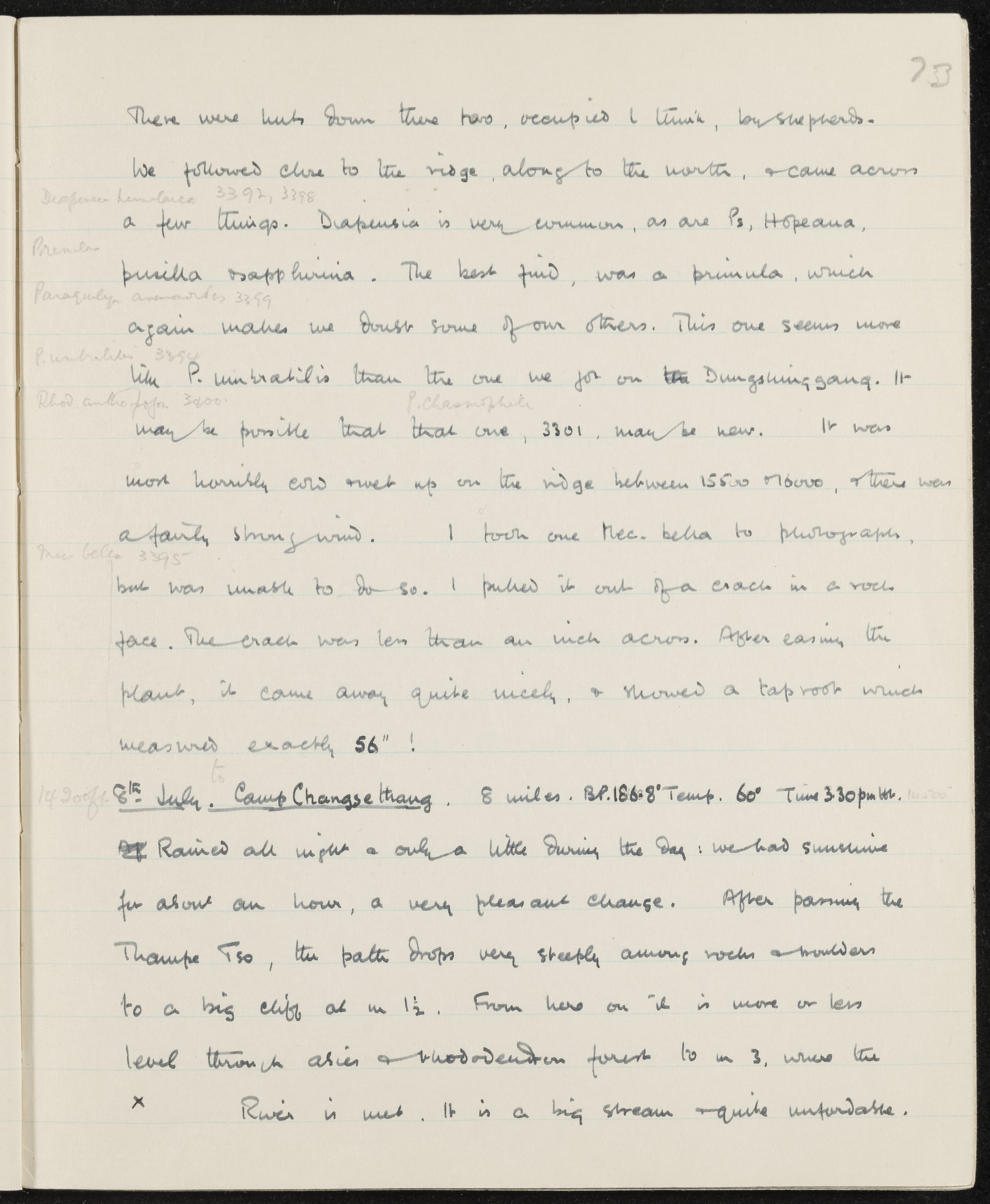
There were huts down there too, occupied I think, by shepherds.
We followed close to the ridge, along to the north, and came across a few things. Diapensia (Diapensia himalaica 3392, 3398) is very common, as are Primula hopeana, P. pusilla and P. sapphirina. The best find was a primula (Paraquilegia anemonoides 3399), which again makes me doubt some of our others. This one seems more like P. umbratilis (3394) than the one we got on the Dungshinggang. It (Rhododendron anthopogon 3400) may be possible that that one, P. chasmophila (3301), may be new. It was most horribly cold right up on the ridge between 15,500 and 16,000; there was a fairly strong wind. I took one Meconopsis bella (3395) to photograph, but was unable to do so. I pulled it out of a crack in a rock face. The crack was less than an inch across. After easing the plant, it came away quite nicely, and showed a taproot which measured exactly 56"!
(14,200 ft.) 8th July. Camp Changsethang. 8 miles. B.P. 186.8° Temp. 60° Time 3:30 p.m.
Rained all night and only a little during the day: we had sunshine for about an hour, a very pleasant change. After passing the Thampe Tso, the path drops very steeply among rocks and boulders to a big cliff at mile 1 1/2. From here on it is more or less level through Abies and Rhododendron forest to mile 3, where the river is met. It is a big stream and quite unfordable.
Appraisal, destruction and scheduling
Accruals
System of arrangement
Conditions of access and use area
Conditions governing access
Conditions governing reproduction
Language of material
Script of material
Language and script notes
Physical characteristics and technical requirements
Finding aids
Allied materials area
Existence and location of originals
Existence and location of copies
Related units of description
Notes area
Alternative identifier(s)
Access points
Subject access points
Place access points
Name access points
- Diapensia himalaica (Subject)
- Meconopsis bella (Subject)
- Paraquilegia anemonoides (Subject)
- Primula chasmophila (Subject)
- Primula hopeana (Subject)
- Primula pusilla (Subject)
- Primula sapphirina (Subject)
- Primula umbratilis (Subject)
- Rhododendron anthopogon (Subject)