Área de identidad
Código de referencia
GB 235 LSH/1/1/2/1/144
Título
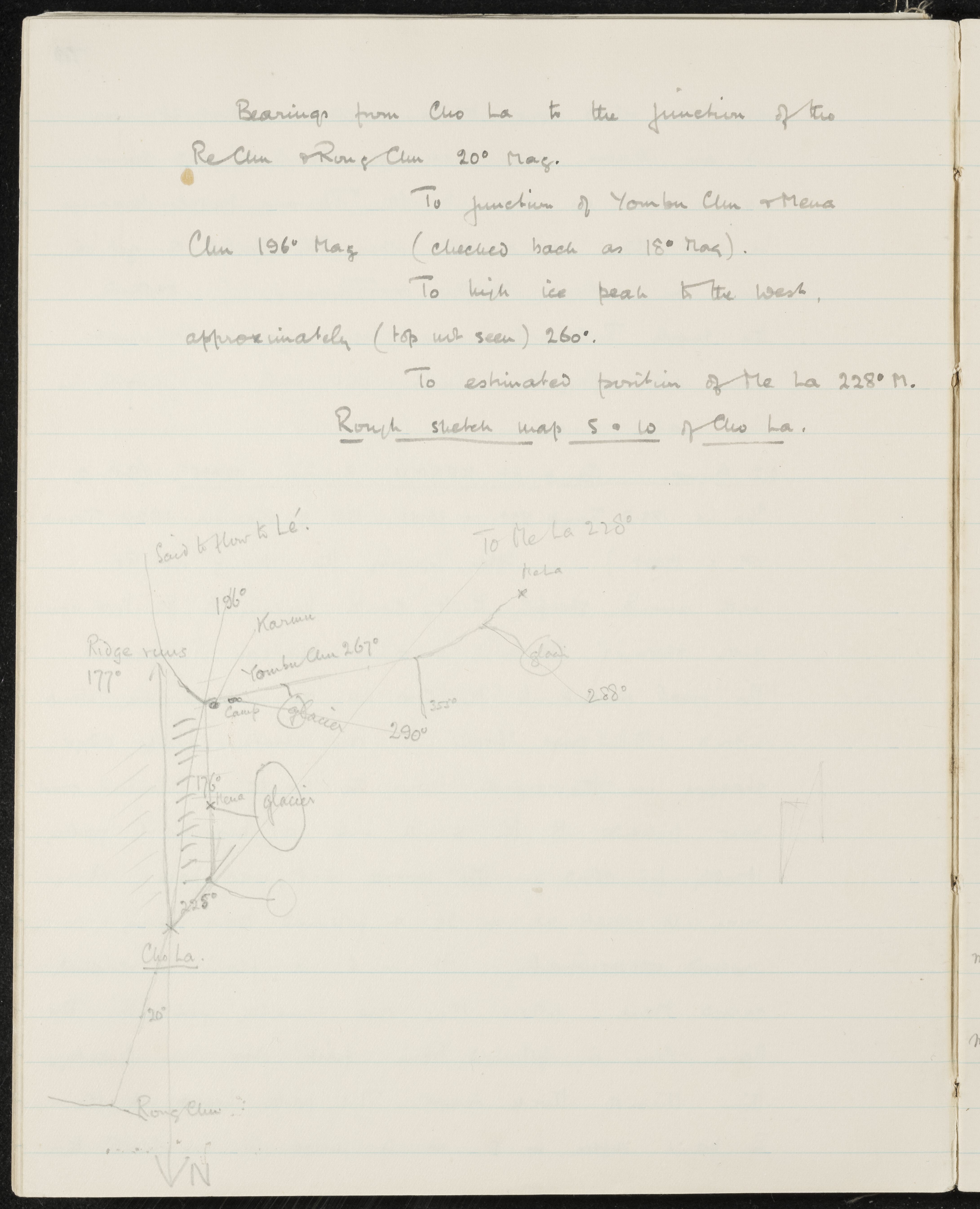
Bearings and sketch map southwest of Cho La
Fecha(s)
- 1933-07-18 (Criação)
Nivel de descripción
Part
Volumen y soporte
1 page
Área de contexto
Nombre del productor
(1898-1967)
Institución archivística
Historia archivística
Origen del ingreso o transferencia
Área de contenido y estructura
Alcance y contenido
SUMMARY:
Records magnetic bearings from Cho La to nearby features including the junctions of the Re Chu and Rong Chu, the Yombu Chu and Mena Chu, a high ice peak, and the Me La. Includes a rough sketch map with labels such as Karmu and a note that a river is said to flow to Lé.
CONTENT:
Bearings from Cho La to the junction of the
Re Chu & Rong Chu 20° Mag.
To junction of Yombu Chu & Mena
Chu 196° Mag (checked back as 16° Mag).
To high ice peak to the west,
approximately (top not seen) 260°.
To estimated position of Me La 228° M.
Rough sketch map S.W. of Cho La.
[Sketch Map Labels]
Said to flow to Lé.
To Me La 228°
Me La
Ridge runs 177°
196°
Karmu
Yombu Chu 267°
glacier
Camp
290°
355°
288°
glacier
176°
Mena
glacier
225°
Cho La.
20°
Rong Chu
N (with arrow)