Área de identidad
Código de referencia
Título
Fecha(s)
- 1983-05-05 (Criação)
Nivel de descripción
Volumen y soporte
1 page
Área de contexto
Nombre del productor
Institución archivística
Historia archivística
Origen del ingreso o transferencia
Área de contenido y estructura
Alcance y contenido
SUMMARY:
Stage-by-stage route notes describe travel from Chichchar toward the Kingkor via Mipa and Potrang to Tontsang, with mileages, elevations, and pass crossings. Mentions road conditions, fuel availability, and key passes including Drölma La, Shagam La, Go La, and Tapgyu La, as well as sites like Tama La Rest House and Dorje Pagmo Lam Tso.
CONTENT:
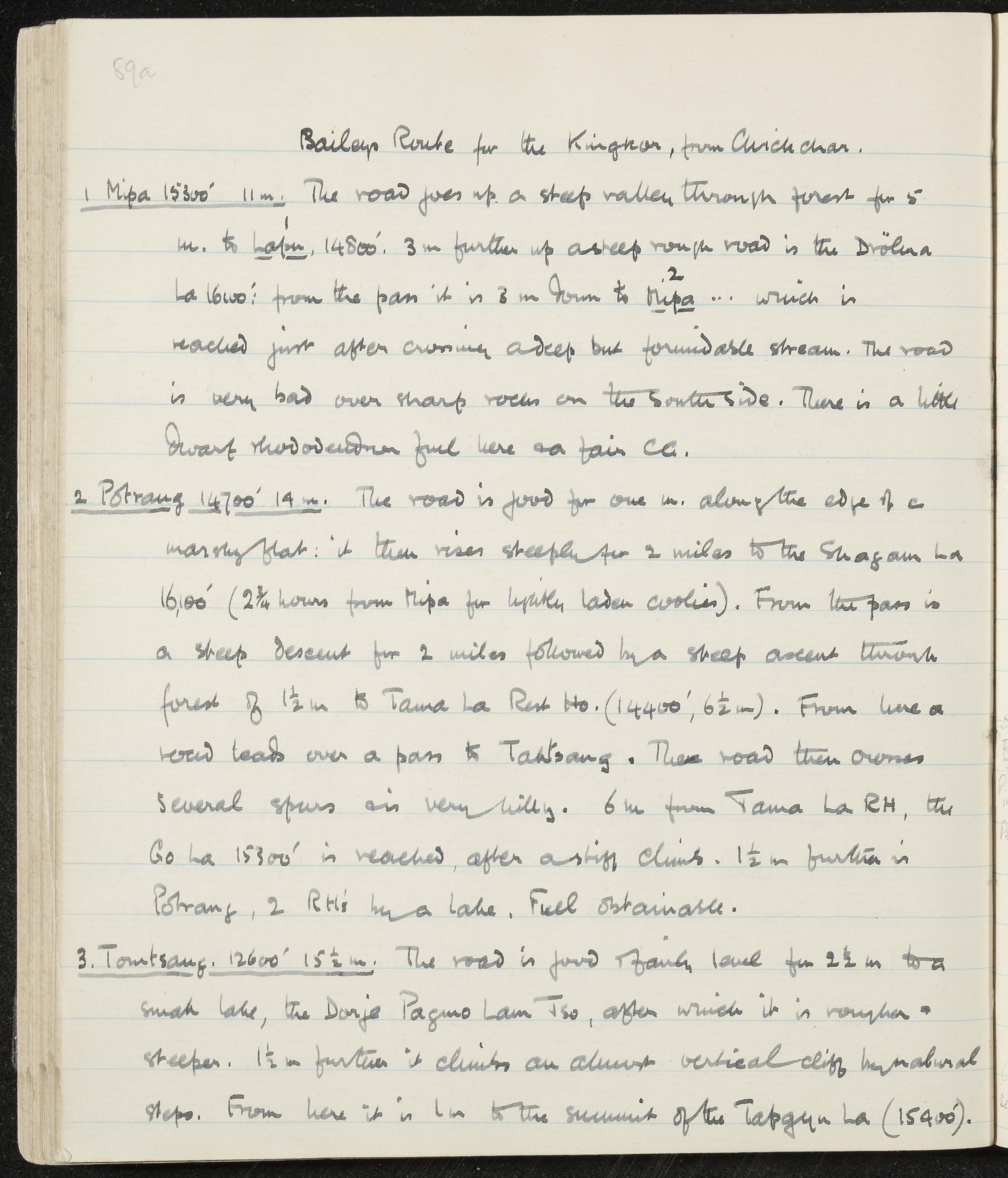
Bailey's Route for the Kingkor, from Chichchar.
-
Mipa 15300' 11 m. The road goes up a steep valley through forest for 5 m. to Lalin, 14800'. 3 m further up a steep rough road is the Drölma La 16100': from the pass it is 3 m down to Mipa ... which is reached just after crossing a deep but fordable stream. The road is very bad over sharp rocks on the south side. There is a little dwarf rhododendron fuel here and fair c.g.
-
Potrang 14700' 14 m. The road is good for one m. along the edge of a marshy flat: it then rises steeply for 2 miles to the Shagam La 16,100' (2 3/4 hours from Mipa for lightly laden coolies). From the pass is a steep descent for 2 miles followed by a steep ascent through forest of 1 1/2 m to Tama La Rest Ho. (14400', 6 1/2 m). From here a road leads over a pass to Taktsang. The road then crosses several spurs and is very hilly. 6 m from Tama La RH, the Go La 15300' is reached, after a stiff climb. 1 1/2 m further is Potrang, 2 RH's by a lake. Fuel obtainable.
-
Tontsang. 12600' 15 1/2 m. The road is good and fairly level for 2 1/2 m to a small lake, the Dorje Pagmo Lam Tso, after which it is rougher and steeper. 1 1/2 m further it climbs an almost vertical cliff by natural steps. From here it is 1 m to the summit of the Tapgyu La (15400).