Showing 6828 results

Archival description
2091 results with digital objects Show results with digital objects
LSH/1/1/5/1/49 · Part · 1933-05-09
Part of The Ludlow & Sherriff Collection

SUMMARY:
Notes mention local talk about the Coronation and cricket scores, and describe buckwheat and rice nearing ripeness. The writer records travel along the right bank of the Mangde Chu through a gorge with Prunus forest up to m 3 where the Wochen Chu enters, and includes a specimen note (Gent. loureirii 3011, 4000 ft) and spelling confirmations for place names.

CONTENT:
is of Bashaling. Most of the talk is of course about the Coronation, but it is nice to hear cricket scores again. The crops just now are all buckwheat, which will be ripe in a week or so, with the rice.

(Gent. loureirii 3011 4000ft)
(Crops: buckwheat, rice)

I'll remove the parentheses.

One more check: "Küngo Rapten". The 'u' has an umlaut.
"Kyi La" - correct.
"kazis" - correct.
"Bashaling" - correct.
"Mangde Chu" - correct.
"Wochen Chu" - correct.
"Pinus longifolia" - correct.
"Gent. loureirii" - correct.

I'll use "Prunus" for "primus".
I'll use "yards" for "x".
I'll use "mile" for "m".

Actually, I'll keep "m 3" etc. as they are clear.

Final check of the text flow.
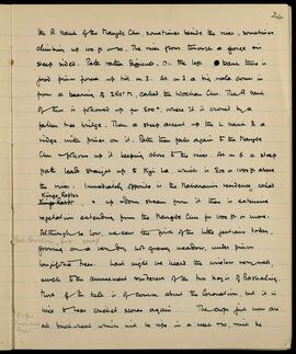
"the R bank of the Mangde Chu, sometimes beside the river, sometimes climbing up 100 ft or so. The river flows through a gorge with steep sides. Path rather difficult. On the left bank there is good Prunus forest up till m 3. At m 3 a big nala comes in from a bearing of 250° M, called the Wochen Chu. The R bank of this is followed up for
LSH/1/1/4/1/34 · Part · 1936-07-02
Part of The Ludlow & Sherriff Collection

SUMMARY:
Notes bird sightings near a high pass and outlines a dated itinerary from Kense to Langong, Pa La, Paba, and Kyimdong Dzong. Summarizes a route from Pachakshiri via Langong and the Pa La along the Tsangpo valley to Nang Dzong, then up the Sipha Chu to Tso Bunang below the Sur La in the Tsari Valley, with a Tit-warbler noted and a return to Sanga, citing diary pages and Ibis references.

CONTENT:
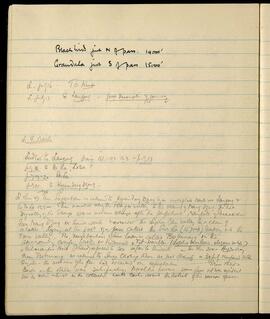
Blackbird just N of pass. 14,000'
Grandala just S of pass 15,000'

L. July 16 - To Kense.
L. July 17 To Langong - Good description of journey

L. H. Route

Ludlow to Langong diary 151-152-153 - July 17.
July 18. to Pa La, Loba
July 19-20 Paba.
July 21. to Kyimdong Dzong.

L. Ibis 47. From Pachakshiri we returned to Kyimdong Dzong by an unexplored route via Langong & the Pa La 15,500. Then marched along the Tsangpo valley to the vicinity of Nang Dzong. The hot dry valley of the Tsangpo was a welcome change after the perpetual rainfall of Pachakshiri. From Nang Dzong we turned south & ascended the Sipha Chu valley to a chain of lakes lying at the foot of a pass called the Sur La (15,700 ft) leading into the Tsari Valley. The neighborhood of these lakes is called Tso Bunang. In the surrounding conifer woods we discovered a Tit-warbler (Lophobasileus elegans subsp.), a Palaearctic point I had expected to see so far to the south. - In Ibis 204 - Aug 20 diary. From Tso Bunang we returned to Sanga

LSH/1/1/4/1/71 · Part · 1933-08-15
Part of The Ludlow & Sherriff Collection

SUMMARY:
The page records route conditions and weather from Mihrang La via Tendong La, joining the Cua La–Chosam route, with observations of flowering gentians. It notes work at Chosam (Tsari), including collecting primula seed and other plant finds, and describes a steep ascent over Sur La to camp at the Tso Bunang Lakes with further gentian observations.

CONTENT:
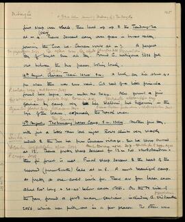
Mihrang La
c 15 miles below Teemaiting Mihrang La & Tendong La

First steep over shale, then level up to the Tendong La (16000') at m 4. Thence descent easy over grass in broad valley, joining the Cua La - Chosam route at m 7. A perfect day of bright sun all day. Found G. nubigena 2033 (Gen. przewalskii 2033, Gen. aglaia 2034, Gen. algida parviflora 2035) full out between the two passes, looking lovely.

14th August. Chosam, Tsari. 14200' 9 m. A lovely day till about 4.0 pm when there was some rain. Got seed of a little primula found here before, now under No 2044 (P. walshii 2044, sikkimensis 2037). Also found a fine gentian by camp, very like waltonii, but differing in the size of the leaves, especially the basal ones (Gent. sikkimensis 2037, prolata 2038, traversii 2039, Gentianella stellariifolia 2039). Other finds: Cyananthus lobatus 2036, lichiangensis 2042, Cremanthodium palmatum rhodocephalum 2040.

15th August. Tso Bunang Lakes Camp. 5 m. 13500'. Another fine day, with just a little rain last night. Route climbs very steeply indeed to the Sur La from Chosam village. Sur La 16000 crossed at 1 1/2. (Aconitum longipedicellatum sp. nov. 2049, Aconitum tsariense sp. nov. 2076). Thence pretty steep descent for 1 1/2 m till rhododendron then fir forest is met (P. crispa 2048). Final steep descent to the head of the second (from South) lake at m 5. A most beautiful camp, as pretty as one could wish for. There are four lakes, each about 500 yards long & 20-40' below each other. On the N side of the pass, found a good many gentians, including G. stictantha 2056 (przewalskii), which was fully out in a few places. The others were...

LSH/1/1/5/1/38 · Part · 1937-05-03
Part of The Ludlow & Sherriff Collection

SUMMARY:
A brief route list noting a 340° bearing and stages (3rd, 2nd, 1st), with nearby locations including passes, rivers, and settlements. Places mentioned are Dunbar La, Nabji, Jirgang Chu, Korsha, Okse La, Bahi Chu, and Cale Chu.

CONTENT:
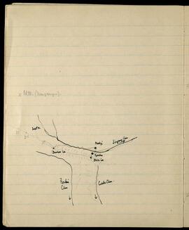
x Bl. Mt. (Dungshigen).

340° M.
3rd, 2nd, 1st
Dunbar La
Nabji
Jirgang Chu
Korsha
Okse La
Bahi Chu
Cale Chu

LSH/1/1/5/1/60 · Part · 1933-05-09
Part of The Ludlow & Sherriff Collection

SUMMARY:
List of places around Chendebi with bearings and estimated travel times to Wangdi Phodrang (1–2 days) and Chirang (4 days). Mentions Sawa La and Sawaphu as not known and notes Phobjikha as a district.

CONTENT:
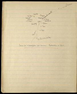
Chendebi
6
70°
2
Tsela
Chogye
Khemjo
To Wangdi Phodrang 1-2 days
Tafe
Gnudusa
Lishe
Pelam
Ganphe
Tao
Sifu
230°
To Chirang 4 days

Sawa La + Sawaphu not known. Phobjikha a Dist.

LSH/1/1/1/1/121 · Part · 1933-08-03
Part of The Ludlow & Sherriff Collection

SUMMARY:
Notes describe views and landslides in the LAO valley and a march up a steep, narrow valley, detailing path crossings, mileages, and ascent to Shingbe. Weather was fine until heavy rain at 4 p.m.; camp lies near glaciers, with one valley leading to the Me La and a path over a fir-covered moraine.

CONTENT:
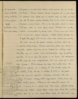
59

B. 24 finished.
Views in the LAO valley. landslide in same valley.
B 25.
Landslide: view down LAO valley.

The path is on the left bank, but crosses at m 1 1/2 to the Right. Thence ascent steep regular to m 4 1/2, where it becomes less steep for a short way. It then continues up the R. bank pretty steeply till m 9 where it again becomes more level. At m 10 the pine forest is left. The last mile is over open land. Shingbe lies in a hollow, surrounded by steep hills. There are fir trees to about 500' above Shingbe. Water and fuel ample. 11.

A good day again till 4.0 p.m., when rain came on heavily. This was one of the finest marches we have had, up a narrow steep valley. Whereas yesterday's path was steep and very bad, after climbing 100 ft, dropped 50', today's kept steadily up, a much more satisfactory way of getting uphill. It is a pity the jungle is so dense. The waterfalls on the way up were magnificent, but we never got a full view of one. From camp we can see quite close the snout of a glacier in a valley to the North, while the one leading to the Me La is rather E of N. and the path goes up over a glacier moraine, covered with firs.

See next page
Me La

LSH/1/1/5/1/113 · Part · 1937-06-07
Part of The Ludlow & Sherriff Collection

SUMMARY:
Notes describe following the Longte Chu to Longtepang and continuing toward Rukubzhi, with plant finds including Primula prenantha, Meconopsis villosa, and identification of Primula tenella. On 13th June, a 10-mile march to Phobsikha via Chele La is recorded, with rain, steep ascents and descents, and observations of Magnolia globosa and a small rhododendron.

CONTENT:
P. smithiana 3250 — See 20th July Yuto La.

...without a stop all day today. Found Primula prenantha today and Meconopsis villosa, but nothing else at all. Path follows down the Longte Chu for 3 1/2 miles to Longtepang, then continues on the main West to East route to Rukubzhi. The primula I have been wondering about, 3249 — is Primula tenella, one of the Obtusifolia section.

13th June. Phobsikha. 10 miles. Height 10,500' approx. Rained all night, but fine till 9:00 in the morning, then rain off and on all day. A tiring march up one pass, then down, and up another, then down here. Saw little but Magnolia globosa, which was common, No. 3253, and a small rhododendron, scarce. Path leaves Rukubzhi and climbs steeply up a ridge on the left bank of a nala at a bearing of 230° to the Chele La, the height of which is approximately the same as the Lausa La. From here a valley leads down to the village of Gufu, near Gangte Gompa at a bearing of 245°. This is followed down till the path comes out of the forest. Then turn South and follow up the next valley. The ascent is very steep, and the La is reached at mile 8. Thence the Phobsikha valley can be seen; the path is steep at first and then eases out of the forest, to camp at mile 11. Phobsikha is still a barren, windy...

LSH/1/1/6/1/100 · Part · 1933-07-05
Part of The Ludlow & Sherriff Collection

SUMMARY:
Stage notes detail travel from Paka toward Ghana La, with crossings near Kongshong and the Paka Phuchu, side routes to Kucha La and Lohung Legu La into Lopa country, and a camp by a hut with a chorten and prayer wheels. Subsequent notes cover progress along the Tsanang Chu past Tsanang Gompa, a difficult ford in the monsoon, and a steep ascent to a disused pass considered impracticable for laden coolies at this season.

CONTENT:
50a

TSANANG

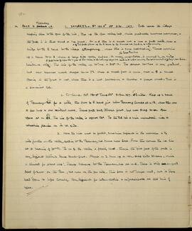
PAKA to GHANA LA. 1. SAMAR 8 1/2 m. BP. 192.5° 58° 3.30. 15/7. Path leaves the village keeping close to the spur of the hill, then up the open valley bed, which gradually becomes narrower, and the path is in thick scrub or tree forest. At m 4 there is a small hut & here a path leads over a bridge to the R bank to the village of Kongshong, where there is some cultivation. (A branch of this path follows up the R bank to the Kucha La, leading to Lopa country.) Thence continue up L bank to m 6 where a large side valley enters. Its river (the Paka Phuchu), unfordable, is crossed by a bridge beside a cliff. (A path takes off before this & goes up this valley to the Lohung Legu La leading to Lopa country. The La is reached in 3 days from Paka.) The line of the valley up to here is 305° M. The ascent to here is very gradual, but now becomes much steeper to m 7 1/2 where a small pass is crossed, and at m 8 a small opening in the forest is met, where there is a hut containing a chorten & prayer wheels. This is a convenient camp.

  1. To Camp. BP. 130.9° Temp 53° 3.0pm. 16/7. 4 1/2 miles. Keep up L bank of Tsanang Chu for a mile, then cross to R bank just below Tsanang Gompa at m 1 1/2, where there are a few huts & one resident monk. Thence path bad, through forest, but never steep to an open space at m 5 1/2. The line of the valley is approx 130°. To the S.E. lies a high mountain, with a retreating glacier on its W. side.

  2. Here the river must be forded, sometimes difficult in the monsoon. 1/2 mile further on the valley leading to the Tsanang Chu turns more East. From this corner the La lies at a bearing of 70° M. To m 2 the valley is fairly level, though the first part of the path is very difficult through dense shrub forest. Above m 2 turn up a very steep side stream, which is climbed for about 1000'. Thence traverse to the Tsanang Chu at m 4. There is still a good deal of snow on the Pass, but none on the far side. This pass is no longer used, but it does lead down to Lopa Country. Very difficult for laden coolies & impracticable at this time of year.

LSH/1/1/6/1/22 · Part · 1938-03-21
Part of The Ludlow & Sherriff Collection

SUMMARY:
Detailed route description from Rong up the side valley via Ringdi Kenza to Lagyari, noting meadows, a Dzong, a gompa, and cultivation. Continues from Lagyari to Lasor over the Putrang/Potrang La (16,470 ft), with steep descents and hills covered in rhododendron, rose, berberis, willow, and birch, and mentions limited supplies. Notes Gent. Waltoni as common along the Tsangpo between Tsetang, Rong, and Lagyari Dzong.

CONTENT:
11a

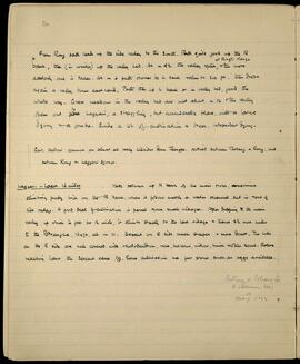
From Rong path leads up the side valley to the South. Path quite good up the R bank, then (in winter) up the valley bed. At m 4 1/2 the valley splits at Ringdi Kenza and the more easterly one is taken. At m 6 path crosses to L bank, climbs 300 ft, then drops again as a valley turns eastward. Path then up L bank or in valley bed, good the whole way. Grass meadows in the valley bed are met about m 12 and the valley opens out to Lagyari, a straggling, but considerable place, with a large Dzong and a gompa. Quite a lot of cultivation and trees. Independent Dzong.

Gent. Waltoni common on almost all rocky hillsides down Tsangpo. Noticed between Tsetang and Rong, and between Rong and Lagyari Dzong.

Lagyari - Lasor. 16 miles. Path follows up R bank of the main river, sometimes climbing pretty high on the R bank, where it follows mostly a water channel cut in side of side valley. A good deal of cultivation is passed and some small villages. After dropping to the main valley, up which it goes for 1/2 mile, it climbs steeply to the last village and thence 2 1/2 more miles to the Potrang La, 16,470, at m 11. Descent on E side much steeper and more direct. The hills on the E side are well covered with rhododendron, rose, berberis, willow, birch and other scrub. Before reaching Lasor the descent eases off. Some cultivation and a few stores such as eggs available.

Putrang or Potrang La
R. vellereum 3557
etc.
Sherriff 11072

LSH/1/1/9/1/41 · Part · 1933-05-07
Part of The Ludlow & Sherriff Collection

SUMMARY:
The diarist describes views of Hashina, a possible route up the Kuru Chu to Lhakhang Dz in Tibet (said to be a four-day journey in July–September by tom-tom), and a day's road from Shambling past a pass toward Diukkhar and a Dzong. Snow at the lower limit of Abies is minimal, rice and makai are growing, and the writer met a man who had been with them at Singhi Dzong in 1933.

CONTENT:
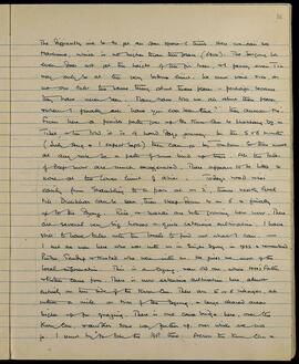
The difficulty will be to get an open space trunk. Here we can see
Hashina, which is no higher than this place (6400'). The Serjong La
even does not get the height of the fir trees, and fancy even Tin
may only be at the very bottom limit. We must wait and see, as
no one tells the same thing about these places - perhaps because
they have never seen. Many have told me all about these places,
and when I finally ask "have you ever seen them?" they answer "no".
From here a possible path goes up the Kuru Chu to Lhakhang Dz in
Tibet, and they told it is 4 hard days journey. In the 5 or 6 months
(July Aug and I expect Sept) they can go by tom-tom. So there must
at any rate be a path of some kind up there. All the tales
of deep snow are much exaggerated. There appears to be little, or
none at the lower limit of abies. Today's road rises
easily from Shambling to a pass at m 2, thence nearly level
till Diukkhar can be seen, then steep down to m 6 and finally
up to the Dzong. Rice and makai are both growing here now. There
are several very big houses and quite extensive cultivation. I have
still to have talks with the locals to find out what I can. —
I met a man here who was with us in Singhi Dzong in 1933 and