Showing 6828 results

Archival description
2091 results with digital objects Show results with digital objects
LSH/1/1/4/1/165 · Part · 1933-10-19
Part of The Ludlow & Sherriff Collection

SUMMARY:
Route notes describe travel from Shio via Karta to Cha, with strong valley winds, riverbank paths, and a crossing to Cha. On 6th November the party proceeds up the eastern valley toward Pen La, encountering snow on the north face and observing herds of bharal.

CONTENT:
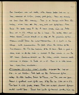
Cha transport was not ready, and the Karta people took me on here, reached at 2:05 pm, pretty good going. Yaks are coming up from Cha this evening. There is a terrific wind down this valley, and has been all day, very cold out of the sun. From Shio the path keeps to the R bank pretty high up, drops down at m 2 1/2 and steep up the L bank. The valley opens out before Karta, which stands on a cliff at the junction of two streams which form the Loro Nakpo Chu. It is quite a big village, with a monastery. The path follows the western of the two streams, the Tra Chu, keeping to the R bank. Path is good and easy and at m 12 the river is crossed to Cha which is on the left bank. Continue straight up the valley, which becomes rather narrower and steeper and tends at m 15. There is a little scrub here, yak dung available.

6th November. GU or GIU 15500? 12 miles. A perfect day. Left at 6:30, in at 3:30 pm. Path leads up the Easternmost of two valleys, the other leading direct to Tsona, via Tre, over one pass. Ascent is gradual most of the way to the Pen La 17330 at m 6 1/2. The last 1/2 mile pretty steep. There was a fair amount of snow on the north face. Passed two herds of bharal pretty high up,
LSH/1/1/2/1/71 · Part · 1933-07-18
Part of The Ludlow & Sherriff Collection

SUMMARY:
Ascent from Thang Chu crossing Rala La (16,871 ft) and Gu La (16,391 ft), then descent to camp at Zangthang, with notes on grazing, shepherds, and a cold afternoon shower. Wildlife observed included partridges, tits, and snow cock; snow and glaciers were seen on nearby peaks and few flowers were noted.

CONTENT:
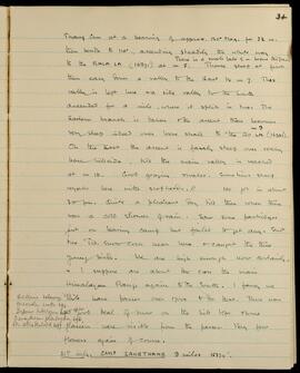
34

Thang Chu at a bearing of approx. 120° Mag. for 3½ m. then bends to 110°, ascending steadily the whole way to the RALA LA (16871') at m 5. There is a small lake ½ m. before the pass. Thence steep at first then easy down a valley to the East to m 7. This valley is left here via side valley to the South ascended for a mile, where it splits in two. The Eastern branch is taken & the ascent then becomes very steep indeed over loose shale to m 9 the GU LA (16391).

On the East the ascent is fairly steep over rocky bare hillside, till the main valley is reached at m 10. Good grazing & water. Sometimes sheep & yaks here with shepherds. // We got in about 3.0 pm. Quite a pleasant day till then when there was a cold shower of rain. Saw some partridges just on leaving camp but failed to get any. Shot two Tits. Snow cock near here & caught the three young birds. We are high enough now certainly, & I suppose are about to cross the main Himalayan Range again to the South. I fancy we have passes over 17000 to do that. There was a good deal of snow on the hill tops & some glaciers were visible from the passes. Very few flowers again of course.

21st July. CAMP ZANGTHANG 9 miles 15374'.

Fritillaria delavayi

LSH/1/1/6/1/74 · Part · 1938-06-15
Part of The Ludlow & Sherriff Collection

SUMMARY:
Diary notes a steep ascent from Trashiyang to Trashi La, descent to the twin lakes Kandro Trü Tso, and onward over Shenjong La to Shacho Pebo, with bearings, barometric readings, temperatures, and times recorded on 15 June 1938. Describes rhododendron zones, yakherd encampments, and a gompa at Shacho Pebo with seasonal resident monks. Mentions plant specimen records from Tsari Sarme.

CONTENT:
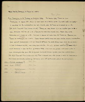
37a

Approx bearing Trashiyang to Trashi La = 40° M.

Tsari Sarme

From Trashiyang to the Tsukang at SHACHO PEBO. The bearing of the Trashi La from Trashiyang is approx 65°, though the path leaves at a bearing of 40°. The path leads up a gully & is very steep till the rhododendrons are left, shortly after the Trashi La is reached at m. 1½. (BP. 185.8. Temp 46°. Time 7.30 am. 15.6.38) Thence an easy descent of a few hundred feet to a lake, KANDRO TRÜ TSO at m 2. (There are two lakes close together here). Ascent easy to the SHENJONG LA (= Mask) at m 2½. This pass is approx 100' higher than the Trashi La. Bearing from Trashi La to Shenjong La = 110° M. Thence descent fairly steep over open hillside, among rhododendrons, past yakherd encampments (not yet occupied 15th June). The path always keeps above the fir forest, & tends to descend slightly, over rocky open hillside. At m 7, the path leads down below rocky cliffs - round the corner is seen the R.H. of SHACHO PEBO - two huts & a gompa - situated under a huge overhanging cliff, from the top of which two small streams of water have been made to flow. (BP. 187.7° Temp 46°. Time 3.30 pm. 15.6.38.) Fuel is stacked here, the gompa is said to have one or two monks permanently resident for the season from 10th of 5th month, (about the end of June).

  1. Primula subularia. Tsari Sarme
  2. Rhod. mekongense Ludlowii. Tsari Sarme
    5560 - Campylogynum. Tsari Sarme
    5565 - charitopes Chancum Series. Tsari Sarme
LSH/1/1/6/1/116 · Part · 1933-07-27
Part of The Ludlow & Sherriff Collection

SUMMARY:
The page describes the route from Tsola Dzong along the Nyang Chu to the Pu Chu, then up the Pu Chu valley past DRUG CHORTEN Gompa and Mirando Gompa, with multiple bridge crossings and a suggested camp site. It notes a pilgrimage circuit toward Mira La, and records B.P. and temperature at Mirando Gompa on 12th August, with a further note at Mira La on 14 Aug. Plant specimens noted include Primula bellidifolia and Dic. leptorrhiz.

CONTENT:
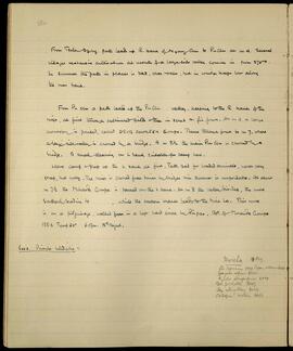
From Tsola Dzong path leads up R. bank of Nyang Chu to Pu chu at m 4. Several villages & extensive cultivation at mouth of a large side valley coming in from 270°. In summer the path in places is bad, over rocks, but in winter keeps low along the river bank.

From Pu chu a path leads up the Pu Chu valley, keeping to the R bank of the river, at first through cultivated fields then in scrub & fir forest. At m 4 a large monastery is passed, called DRUG CHORTEN Gompa. Thence through forest to m 7, where a large side valley is crossed by a bridge. At m 8½ the main Pu Chu is crossed by a bridge. A small clearing on L bank, suitable for camp here.

Leave camp & keep up the L bank at first. Path bad for loaded animals, never very steep, but rocky. The river is crossed four times by bridges & in summer is unfordable. At about m 7½ the Mirando Gompa is passed on the L bank. At m 8 the valley divides, the more southerly leading to [blank], while the western branch leads to the Mira La. This route is on a pilgrimage, walked round in a left hand circle by Pilgrims. B.P. of Mirando Gompa 188.2 Temp 50° 6.0pm. 12th August.

  1. Primula bellidifolia

Mira La 14 Aug.
Dic. leptorrhiz

LSH/1/1/2/1/119 · Part · 1933-07-18
Part of The Ludlow & Sherriff Collection

SUMMARY:
The page details a route starting from Tsona Dzong across a plain to Nyaba La (approx. 15,250 ft), then past lakes to Gorpo La (17,779 ft), with notes on terrain, glaciers, and an easy western descent toward the Nyam Jang valley. Margin notes headed 'Gorpo La Aug. 15' list plants observed or collected, including Saxifraga, Scabiosa, Geranium, Caragana, Meconopsis, and Corydalis.

CONTENT:
58

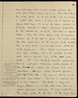
very small pass, past ruined village, joining the route from Tsona Dzong at mile 4. From Tsona Dzong the route skirts the East end of the hill and crosses a broad open plain, and runs at a bearing of approximately 325° Magnetic. At mile 4 the plain narrows, and the path ascends a valley, climbing gradually to the Nyaba La at mile 6. This pass is approximately 15,250 feet, where the route splits, one to Dongkar keeping up to the left and going due north, while the other leads down to the West end of the Nyaba Tso, a lake about 1 mile x 1/2 mile broad to the East of the Nyaba La. From Nyaba La proceed North over open hillside. At mile 8 another similar sized lake is passed, lying to the East of the path. At mile 9 the path ascends, gradually turning westward and climbing pretty steeply to the Gorpo La, which lies between two high mountains, from which several glaciers fall to the Southeast. The one on the North must be well over 20,000 feet. The La is reached at mile 11 and is 17,779 feet. The path is rocky but easy. Descent on West side also easy, down a series of small plateaus. A route leads down the main valley to the West to the Nyam Jang.

[Margin Notes:]
Gorpo La Aug. 15
Saxifraga punctulata 820
" mutans 822
" lychnitis 874
Scabiosa hookeri 821
Geranium humile 833
Caragana jubata 825
Meconopsis horridula 826
pale lavender Corydalis (previously) 799 no label 17,500 ft
pale yellow anemone

LSH/1/1/2/1/69 · Part · 1933-07-18
Part of The Ludlow & Sherriff Collection

SUMMARY:
After a late start from Tsuna, the party visited the Dzongpon to fix prices, then traveled via the Drong toward Lablung, ascended to the Nyongchung La, and descended into the Thang Chu valley where fuel and grazing were noted. Few flowers were seen, but a delphinium and a Corydalis were recorded; Himalayan blackbirds were numerous at Thang and gazelle were observed in the valley.

CONTENT:
33

= 14869 x 1.05 = 15612'. Ht of Thang = B.P. 186.4°, Temp. 52°.
Mean with Pass 56° = 13903' x 1.015 = 14120'.

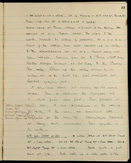
Leave camp at Tsuna village & proceed to the Drong, reached at m 1. Thence across the plain to the north, towards the village of LABLUNG. At m 2 — ½ m short of the village turn right handed up a valley to the NYONGCHUNG LA at m 4. Ascent easy over open hillside. Bearing from La to Tsuna = 235° Mag. Rather steeper descent at 60° Mag to the Thang Chu valley. Follow up this valley across by a bridge at m 6. Good C.G. fuel available but limited: grazing, food.

A very late start, not moving off till nearly 10 am. Then a call on the Dzongpon till 11 while prices were fixed. Few flowers seen. A nice delphinium on the way up the valley to the pass, & a beautiful little Corydalis at the very top. Himalayan blackbird at Thang fairly numerous. Saw gazelle in the valley.

[Marginal notes:]
Delphinium pylzowii 657
Corydalis 658
Arenaria glanduligera 659
And

LSH/1/1/6/1/72 · Part · 1938-06-09
Part of The Ludlow & Sherriff Collection

SUMMARY:
The page describes the route from the Upper Bridge over the Lanjung to Sinjo Samba, including bridge crossings and path conditions through fir forest. At Tsari Sama (13 June), the author records Primula collections (Nos. 5537–5541), discussing color variation among P. sikkimensis forms and considering P. ioessa and P. Hopeana as true species. Additional route notes describe a path from the lower bridge up the right bank to Trashijing, a small gompa site used by yakherds, with reference to Tolo and the Lanjung Chu.

CONTENT:
36a

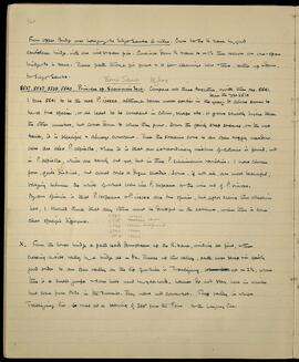
From Upper Bridge over Lanjung to Sinjo Samba 6 miles. Cross to the R bank by good cantilever bridge, with one mid stream pier. Continue down R bank to m 1 1/2 then recross on one-span bridge to L bank. Thence path through fir forest & a few clearings here & there, rather up & down, to Sinjo Samba.

Tsari Sama 13 June

5537, 5538, 5539, 5540. Primulae sp. sikkimensis Sect. Compare all these together, & with them No. 5541.
I take 5541 to be the real P. ioessa, although taken much earlier in the year than the type 2514. It alone seems to be a true species, or at least to be constant in colour, shape etc. It grows slightly higher than the other numbers, but comes down to where they grow. Down the fairly steep streams, on the wet banks, it is plentiful & always constant. Then the streams come to an open boggy meadow. Here are also P. alpicola, & here it is that an extraordinary mixture of colours is found, not in P. alpicola, which are barely out yet, but in these P. sikkimensis varieties. I have chosen four, quite distinct, but could take a dozen shades. Some, if not all, are most beautiful, varying between the white of what looks like P. Hopeana to the wine red of P. vinosa. My own opinion is that P. Hopeana & P. ioessa are true species, but after seeing this collection here, I should think that any others must be doubtful in the extreme, unless there is some clear specific difference.
5537 cocoa
5538 reddish cocoa
5539 cocoa incipient
5540 cocoa
5541 cocoa

X. From the lower bridge a path leads downstream up the R. bank, winding at first, then crossing a side valley by a bridge at m 3/4. Thence up this valley, path never steep & in fairly good order to an open valley on the lip of which is Trashijing, at m 2 1/2, where there is a small gompa & some huts used by yakherds. Lamas do not stay here in winter but come from Tolo in the summer. They have not come yet. The valley in which Trashijing lies, runs at a bearing of 340° from the Pass to the Lanjung Chu.

Route itinerary, 1936
LSH/1/1/3/3/6 · Part
Part of The Ludlow & Sherriff Collection

SUMMARY:
A list of route stages for a 1936 journey, outlining a sequence from Diwangiri through Trashigong, Gamri Chu, Sakten, Tsona, Chayul Dzong, Sanga Chöling, Migyitun, and ending around Takpa Shiri. The page records place-to-place progression without daily dates or personal names.

CONTENT:
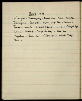
Route. 1936.

Diwangiri - Trashigong - Gamri Chu - Mera - Sakten -
Trashigong - Changpu - Nyam Jang Chu - Trimo -
Tsona - Loro tö - Chayul Dzong - Lung - Chayul Dz.
Le La - Charme - Sanga Chöling - Cha La -
Migyitun - Bimbi La - Chuchchar - round Takpa
Shiri -

LSH/1/1/5/1/102 · Part · 1928-06-02
Part of The Ludlow & Sherriff Collection

SUMMARY:
Brief note describing a valley that divides in two, with the northernmost branch followed up steeply from m 8 to m 11. Records specimen 3702 as Rhod Baileyi.

CONTENT:
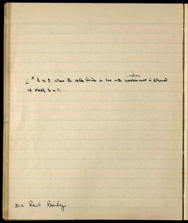
∠^x to m 8, where the valley divides in two the northernmost is followed
up steeply to m 11,

3702 Rhod Baileyi.

LSH/1/1/3/3/104 · Part · 1933-04-09
Part of The Ludlow & Sherriff Collection

SUMMARY:
Notes that it is three days to Lung. Describes the Chayul river cutting a difficult gorge through the main range about 10 miles downstream. Includes several numerical notations.

CONTENT:
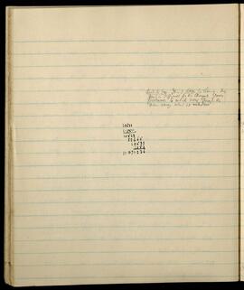
Acct. to Gov. It is 3 days to Lung. The
gorge is difficult as the Chayul river
proceeds to cut its way through the
main range about 10 miles down.

10533
1.0511

10533
52665
10533
1053

11071.236