Showing 6828 results

Archival description
2091 results with digital objects Show results with digital objects
LSH/1/1/8/1/112 · Part · 1952-05-17
Part of The Ludlow & Sherriff Collection

SUMMARY:
Notes a 12‑mile route from Yangtso to Gyao with bearings to Yala Shambo and from Cyachungha to Chilungha. Describes ascent to the Cyachungha pass (~16,500'), descent to the Sikung River, climb to Chilung La (~16,500'), passing drogpa encampments, and arrival at Gyao with a monastery where the Nyam Sang Chu joins.

CONTENT:
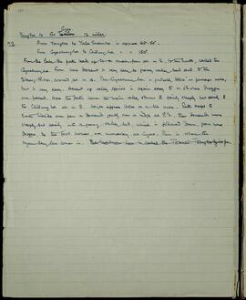
Yangtso to Gyao. 12 miles.

N.B. From Yangtso to Yala Shambo is approx 45° - 50°.
From Cyachungha to Chilungha is approx 150°.

From the lake the path leads up to a small pass at m 1/2, to the South, called the Cyachungha. From here descent is very easy to grassy valley bed and to the Sikung River, crossed at m 4. The Cyachungha is probably 16500' or perhaps more, but is very easy. Ascent up valley opposite is again easy to m 6 1/2 where drogpa are passed. Here the path leaves the main valley and turns E fairly steeply but easily to the Chilung La at m 8. Height approx 16500 or a bit more. Path keeps to South hillside over pass and descends gently over a ridge at 8 1/2, then descends more steeply but easily into a grassy valley bed, which is followed down, past some drogpa, to the first houses, and a monastery, at Gyao. This is where the Nyam Sang Chu comes in.

LSH/1/1/3/3/63 · Part · 1936-03-10
Part of The Ludlow & Sherriff Collection

SUMMARY:
Travel over a ridge to Changpu with cultivation; vegetation noted as rhododendron and deciduous oak, a primula without flowers near camp, and a drawn study of a small-flowered magnolia above camp. The party then marched about 4 miles to Sanglung, crossing the frontier at a side nala, passing a small village, with rain from midday; inhabitants mostly Takpas with some Tibetans and few flowers seen apart from an acacia.

CONTENT:
Then steadily up pretty steeply most of the way over a ridge to Changpu. There is some cultivation on the way, and a lot at Changpu. Here the vegetation is mostly rhododendron deciduous oak. I found a primula growing in a damp place close to camp, but no flowers to be seen. All had been eaten by sheep & cows. Dawaing for an interesting magnolia, new to us, 1220. Flower much smaller than M. Campbellii. It is above camp about 800 yards up from the path. We are in for a good deal of trouble now I fear. Marches seem to be restricted to 3 or 4 miles, & we are at the frontier tomorrow, where transport will be very uncertain.

22nd March. To Sanglung. 4 miles. B.P. 202.7° Temp. 63. Approx Ht. 5208'.
Road is down hill for 1/2 mile, crossed the frontier at an insignificant side nala, then climbs gradually to a ridge where at m 2 Behing a small village is passed. Thence down hill, steeply in places to a side nala & up to Sanglung on the other side. Inhabitants nearly all Takpas, with some Tibetans. It rained a little last night, & again today from midday onwards. No flowers seen but an acacia

LSH/1/1/6/1/16 · Part · 1938-03-21
Part of The Ludlow & Sherriff Collection

SUMMARY:
The diary describes traveling from Kampa Padze down to the right bank of the Tsangpo, along cultivated land, then ascending 500 ft to the TAB LA pass. After a similar descent and a flat plain, the route returns to the river at mile 10 and reaches the Dzong on a rock at mile 11.

CONTENT:
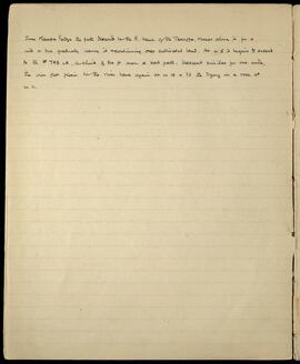
From Kampa Padze the path descends to the R. bank of the Tsangpo, keeps along it for a mile or two, gradually leaving it & continuing over cultivated land. At m 5 it begins to ascend to the TAB LA, a climb of 500 ft over a bad path. Descent similar for one mile, then over flat plain to the river bank again at m 10 & to the Dzong on a rock at m 11.

LSH/1/1/6/1/154 · Part · 1938-10-22
Part of The Ludlow & Sherriff Collection

SUMMARY:
The page lists an itinerary from Langong to Migyitun via Pala, Öla, Chubumber La, Rimbu, Lingtsang La, and Yu La, with an alternative route via Tso Kar. It also notes a route to Kyimdong Dzong.

CONTENT:
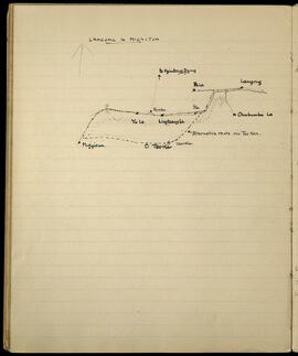
LANGONG to MIGYITUN

to Kyimdong Dzong

Langong
Pala
Öla
Chubumber La
Rimbu
Lingtsang La
Yu La
Migyitun
Tso Kar
Alternative route via Tso Kar.

LSH/1/1/5/1/139 · Part · 1936-06-27
Part of The Ludlow & Sherriff Collection

SUMMARY:
Describes the route along the left bank of the Rinchen Chu from Maruthang, including forest entry, stream crossings, grazing areas, and wet weather conditions. Notes that Primula involucrata and P. sikkimensis flourish, and records collecting a distinctive lemon-colored primula possibly a variety of sikkimensis.

CONTENT:
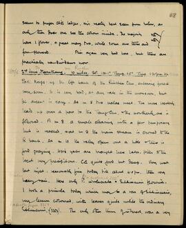
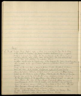
seems to prefer cliff ledges, and are really best seen from below, as
only then does one see the colour inside. The majority
have 1 flower, a great many two, while some are three and
four flowered. Flies again very bad here, but there are
practically no dimdams now.

11800 ft 2nd June. Maruthang to via Rinchen. 10 miles. BP. 191.1° Temp. 65° Time 1.30pm. Ht. 12,400

Path keeps up the left bank of the Rinchen Chu, entering forest
very soon. It is very bad, at any rate in the monsoon, but
the ascent is easy. At m 5 two nalas meet. The more westerly
leads up over a pass to the Tang Chu, the northerly one is
followed. At m 8 a small clearing with a few temporary
huts is reached, at m 9 the main stream is crossed to the
R bank. At m 10 the valley opens out a little & there is
good grazing. Its yaks are brought here later. Hills to the
west very precipitous. CG quite good but damp. Very wet
last night: reasonably fine today till about 4.0 pm, then very
heavy rain. Here only P. involucrata & Sikkimensis flourish.
I took a primula today which may be a var of sikkimensis,
very lemon coloured, with leaves quite unlike the ordinary
Sikkimensis, (3353). The only other thing of interest, was a very

LSH/1/1/5/1/43 · Part · 1937-05-06
Part of The Ludlow & Sherriff Collection

SUMMARY:
The party leaves Naszi, traverses along the Tirgang Chu, crosses side valleys, and turns up the Mangde (Trongsa) Chu above the river, noting oak and Pinus longifolia forests and cultivation near Nimshong. It rains intermittently, and during a halt Tendu, Trongpen, and the diarist press a fern when a serow suddenly charges past them.

CONTENT:
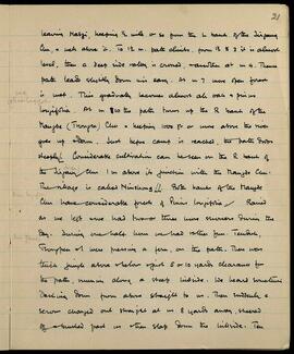
Leaving Naszi, keeping 1/2 mile or so from the left bank of the Tirgang Chu, and well above it. To 1 1/2 m. path climbs, from 1 1/2 to 3 it is almost level, then a deep side valley is crossed, and another at m 4. Thence path leads slightly down and is easy. At m 7 more open forest is met. This gradually becomes almost all oak and Pinus longifolia. At m 8 1/2 the path turns up the right bank of the Mangde (Trongsa) Chu and keeping 1000 ft or more above the river goes up stream. Just before camp is reached, the path drops steeply. Considerable cultivation can be seen on the right bank of the Tirgang Chu 1 m above its junction with the Mangde Chu. The village is called Nimshong. Both banks of the Mangde Chu have considerable forests of Pinus longifolia. Rained as we left and we had two or three more showers during the day. During one halt however we had rather fun. Tendu, Trongpen and I were pressing a fern, on the path. There was thick jungle above and below and just 5 or 10 yards clearance for the path, running along a steep hillside. We heard something dashing down from above straight to us. Then suddenly a serow charged out straight at us 8 yards away, sheered off and brushed past us then slap down the hillside. Ten

LSH/1/1/5/1/88 · Part · 1937-05-29 - 1937-05-28
Part of The Ludlow & Sherriff Collection

SUMMARY:
Route description from a village in Phobshikha along the right bank of the Mara Chu, descending past side valleys and waterfalls to Trashi La and rejoining the river. Notes include heights with times and dates, and the route continues to Adao at mile 12, with the Mara Chu flowing toward the Wangdipotrang Chu.

CONTENT:
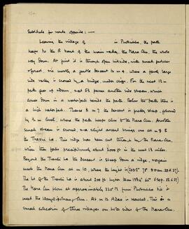
Substitute for route opposite: —

Leaving the village of [blank] in Phobshikha, the path keeps to the right bank of the main valley, the Mara Chu, the whole way down. At first it is through open hillside, with small patches of forest, and is mostly a gentle descent to mile 4, where a fairly large side valley is crossed by a bridge, under cliffs. For the next 1½ miles the path goes up and down, and at 5½ passes another side stream, which comes down in a waterfall beside the path. Below the path there is a high waterfall. Thence to mile 7 the descent is pretty steep, followed by ½ mile level, where the path keeps close to the Mara Chu. Another small stream is crossed, and a slight ascent brings one at mile 8 to the Trashi La. This ridge has been cut through by the Mara Chu, which then falls precipitously about 3000 ft in the next 1½ miles.

Beyond the Trashi La the descent is steep down a ridge, and again meets the Mara Chu at mile 10, where the height is (203.8° 73° 9.0 am. 29.5.37). The height of the Trashi La is about 200 ft higher than 198.4° 65° 5.30 pm 28.5.37. The Mara Chu flows at approximately 220° M from Phobshikha till it meets the Wangdipotrang Chu. At mile 12 Adao is reached. This is a small collection of three villages on both sides of the Mara Chu.

LSH/1/1/2/1/33 · Part · 1915-05-29
Part of The Ludlow & Sherriff Collection

SUMMARY:
Mentions a flowering specimen at Punakha on 29 May 1915 and doubts about obtaining seed. Provides a detailed route description from Phungui across side valleys and bridges along the Gauri Chu to the Munde La, noting waterfalls, villages, and Takpa inhabitants.

CONTENT:
certainly Cooper's 3937, found at Punakha at 5000'
in flower on 29th May '15. It is a fine flower, but
I doubt if we could get the seeds. I saw it growing
on rocky ground about ½ mile above the bridge over
the main Gauri Chu, on the R. bank - 30 yards off
the road to the right, and again close to the road a little
further on. // Leaving Phungui the road drops and
crosses a side valley which leads up to the Sikkim
La. Then up, and again down to a side valley, the
Murbe Chu at m 3. Both are crossed by bridges, and the
latter is a fair sized river. Again the ascent is steep,
over a ridge and down to the L bank of the Gauri Chu at m 5.
This is followed to m 6½ where the Gauri Chu is
crossed by a bridge to the R bank. Path gradually
climbs and crosses a side valley at 7½. Thence ascent
very steep, over a ridge and past a fine waterfall at m 8.
Then past a village at m 9, it turns slightly left and
an exceedingly steep ascent begins, after crossing a side
valley at m 10. The path is stepped for a great part
of the steep climb to the Munde La (about 9600') at m
12½. Most of this is through jungle. At the Munde La,
the country opens out and slopes of wonderful grazing are
around. There are several villages near here and the
inhabitants are Takpas, more nearly allied to Tibetans.

LSH/1/1/4/1/60 · Part · 1933-07-23
Part of The Ludlow & Sherriff Collection

SUMMARY:
The party left Sanga Chöling, crossed the Traessen La, traversed high dry country to the Tsari valley, visited Tsobermang, and descended the Tsari Chu to Migyitun, unsuccessfully seeking Sclater's Monal. With flowering largely over by late September, they separated for seed collecting, sending two collectors to Pachakshiri, while returning via Kyimpu where Himalayan Crossbills were abundant. Sherriff collected seed on the main range above Lung, and later L. and the narrator went via Tsana and Tawang to Sakden, where Shanth rejoined at Dewangiri.

CONTENT:
Route

L. Iris H. We left Sanga Chöling again on Aug. 6 and ascended the Char Chu to Shing. We then crossed the Traessen La (16,900) and worked eastwards through unexplored country to the head of the Tsari valley. The country traversed on this part of our journey was very elevated, and lay entirely within the dry zone. The birds met with were mainly those of the plateau, and of no particular interest.

We paid another visit to Tsobermang and then descended the Tsari Chu to Migyitun where we made another effort to obtain specimens of Sclater's Monal, but without success.

It was now the end of Sept., and except for Gentians and a few other plants, the flowering season was over, so we decided to separate again for the seed harvest.

Having sent 2 of our collectors to Pachakshiri, we returned to Sanga Chöling to pick up the remainder of our baggage, and descended the Cha Chu to Kyimpu. Kyimpu lies at the foot of the Le La at an altitude of 13,500 ft. Here in the conifer woods I encountered a bird I have sought in vain for many years. This was the Himalayan Crossbill (Loxia curvirostra himalayensis), another rarity according to the textbooks. Here at Kyimpu however it was very common, feeding in large flocks in larch trees. (Nos 348)

From Kyimpu Sherriff returned to the passes on the main range above Lung and spent a month collecting seed.

L. and I. returned to Tsana and from thence to Sakden via Tawang. From Sakden to Dewangiri where Shanth rejoined them on Nov. 24.

LSH/1/1/1/1/123 · Part · 1933-08-04
Part of The Ludlow & Sherriff Collection
  • SUMMARY:
    Describes the route from Shingbe up to the Me La (c. 16,000 ft), noting terrain from fir forest to open grassland and the descent beyond into an open valley along a river. Discusses uncertain boundary markers (Me La, a river beyond, or the higher Cho La 15–20 miles further) and mentions Tibetans with yaks, fair grazing, and high ice-covered mountains; notes fine weather until 3 pm and a 6 am departure.

CONTENT:
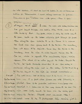
are both certain, I can't see how to settle it, as we have no
boiling pt. thermometer. I must always have one in future.
There are a few Tibetans here with yaks, and there is fair
grazing.

5 4th August. ME LA. 16000' (Pass at Shingbe 14300') 3/4 miles. The main LAO valley divides into
two just beyond Shingbe, one leading to the North, one to a
little South of East. The path, which is easy the whole way to
the pass, leads up the latter, climbing first through fir forest,
then along the open hillside for 1 1/2. Thence it is more or
less level over open grassy land to the Me La. The boundary
does not seem to be definite. Some say the Me La is the
boundary, some the river 1 1/2 miles beyond and some say the
Cho La, which is reported to be considerably higher, and which
appears to be about 15-20 miles beyond the Me La. Beyond the
Me La, the path descends about 500' to an open valley and
continues along the river met in this valley. To the N. E. and S. of
the Me La, and beyond it, are high ice covered mountains //

B. 25 contd

  • Fine until 3.0 pm. Left at 6.0 am and went to the