Showing 6828 results

Archival description
2091 results with digital objects Show results with digital objects
LSH/1/1/5/1/9 · Part · 1937-04-01
Part of The Ludlow & Sherriff Collection

SUMMARY:
Records epiphytic plants in dense, wet forest with specimen numbers, followed by a detailed account of the trek with steep ascents, leeches, and elephant signs near Hatisar. Notes heavy rain overnight, a cleared camping site with water, and a 4½-mile stage to Surelakha (S. Bhutan).

CONTENT:
Growing on trees in dense, wet forest
Agapetes variegata var elegans 2920, Agapetes salignum 2926, Dendrobium aphyllum 2924, Dendrobium 2927
Curcuma aromatica 2921 Coelogyne ochracea 2930

Camping site is available till we reached this clearing in the jungle which has been specially made. When we left it poured solid rain for an hour, then cleared up for the rest of the day. Very hot and sticky, otherwise not too bad. Path easy through dense forest to m. 1 1/2. Then steep ascent to m. 4, over a ridge, beyond which it drops 500 ft to m. 5 1/2, where a small nala is crossed. This might be difficult in the summer. From here to m. 9 ascent is steep, all through dense jungle, thence level to a small clearing in the forest, where good water is available. Leeches very bad all the way, and low down the leeches are a nasty looking kind, brown and big. We saw many elephant droppings, and elephants are said to be very common here - Hatisar. One pony came with us with a load, and it was covered with leeches - a beastly sight.

25th April - Surelakha (S. Bhutan) 4 1/2 miles
Very heavy rain during the night. It rains here more solidly than I have ever seen before, but we have been lucky so far, the days
LSH/1/1/5/1/39 · Part · 1937-05-03
Part of The Ludlow & Sherriff Collection

SUMMARY:
During a slippery descent, Tsongpen comments on the path, and men from Naszi report heavy rain that ruined buckwheat crops. The author measures Rhododendron leaves, notes primulas in flower, and records bearings to Naszi and Korkhu with mapping notes for Gali Chu, Okse La, Dunhar La, Bahi Chu, and the Black Mt.

CONTENT:
19

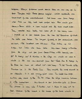
slippery, though of course much easier than on our way up. In fact Tsongpen said 'Rasta pakka hogiya', which certainly was somewhat of an overstatement. Met some men from Naszi who told us they had had awful rain there which just came down solid & has ruined all the buckwheat crops. They wanted rain badly but have got it too heavy now.

I picked up a few leaves from the tree the specimen of Rhododendron (R. falconeri 2883) No. 2983 was taken. The longest, of only a few examined, was 44 cms, the broadest was 19 1/2 cms. Fine today up till 3:00 pm, but looks like rain later. We saw Naszi & Korkhu from the ridge not far from Camp 2nd May & the bearing was 95° to Naszi, 100° to Korkhu & the ridge on which we were & which is the one we crossed from the Gali Chu to Naszi by the Okse La runs at about 110° - 290° Mag. To the south of the Dunhar La is the Bahi Chu. Very roughly the map should be as opposite. It is all wrong just now. The Gali Chu stops a long way short of the Black Mt. & has the ridge running between it & the mountain. We found a few primulas 2984 (Pr. bracteosa 2991, common) in flower.

The flower is very like P. boothii, but I think it may not be that, because of the bracts & the shape of the leaf which is (Rh. keysii 2992)

LSH/1/1/9/1/73 · Part · 1949-06-15
Part of The Ludlow & Sherriff Collection

SUMMARY:
The writer reports heavy rain and a reconnaissance up the valley toward Waitang, finding the route likely passable despite earlier warnings that yaks could not traverse it. They plan to leave via Pangstang and criticize Ngudup for not negotiating effectively with locals. Botanical collections include Primula pusilla, P. bellidifolia, P. reticulata, Mec. paniculata, and observations comparing P. alpicola var. luna and P. reticulata.

CONTENT:
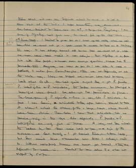
thorn scrub, it was very difficult indeed to move, or to get a clear shot at the bird. I hope something may come out. We have decided to leave here on 12th, and to go via Pangstang. I am sure if Ngudup had guts now, he could fix up the other route.

11th June Halt. I decided to go as far as I could up the valley where we had been told we could not go - yaks would be unable to take us to Waitang this way. It has always seemed odd to me that we could not go, when one man came back and said it was alright. But Ngudup is a poor fish with these people, and never asks enough questions, and never tries to persuade them. Anyway we went as far as I was able to walk - probably 3 miles from Garmotangha, there was no difficulty at all the whole way. Where we stopped we might have had to carry loads about 50 yds. We had quite a good day - got P. pusilla, P. bellidifolia and P. reticulata, the latter uncommon, but plentiful and beautiful where found. We also got Mec. paniculata in flower. The local form of P. alpicola var. luna is very like P. reticulata. In fact I was leaving reticulata today after having started to take it, when I noticed the absence of the very large bracts, which should have been obvious. Then later I saw that reticulata has no farina ring in the eye like alpicola. P. pusilla and P. bellidifolia are only just in flower. A very wet day indeed - the wettest by far that we've had so far, a sign of the monsoon at last surely. I got soaked through bottom half, but don't mind that, and remember now that I always used to. Without waterproof trousers, one must get soaked, and they are difficult to walk in. Started to rain about 8.0 and has not stopped by 5.0 pm.

LSH/1/1/2/1/91 · Part · 1933-07-18
Part of The Ludlow & Sherriff Collection

SUMMARY:
The diarist records compass bearings from Chera La to several snow peaks and notes that two western peaks with glaciers are uncharted. Due to locals stating there is no yak route to Chera and limited manpower, the party decides to split: the diarist with A. Sheikh, Gulla, and Kurtip to Chera, and Ludlow with Pintso, Ramzana, and Danong to Luguthang.

CONTENT:
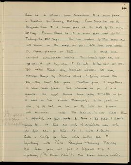
Chera La as follows: from Chirachun to a snow peak in direction of Tawang 284° Mag. From Chera La up the Dongma Chu to a snow peak at the head of the river 36° Mag. From Chera La to a snow peak west of the Tulung La 332° Mag. The two western of these peaks are not shown on the map at all. Both look over 20,000 ft. and have glaciers on them. In camp here, we find considerable trouble. The locals now say we cannot get by yaks to the mountains to the west at all. This makes things very difficult indeed. We may manage things by dividing camp, I going where they say they can't take yaks, and Ludlow going to Luguthang or some such place. But wherever we go, it is a gamble. We must choose some valley to settle in for a week or two and work thoroughly. If it's good, we win, if it's bad we lose, as the time for flowers will be over.

NB
To split up:—
S to Chera
L to Luguthang

Later. The decision is now made: there is definitely no yak route to Chera — the place I intend going to. As there are only 15 available men, only one of us can go there. So I, with A. Sheikh, Gulla and Kurtip go there; while Ludlow goes to Luguthang with Pintso, Ramzana and Danong. They say that laden yaks will find it difficult to go to Luguthang ("the sheep plain"). Our boxes are so unlike

LSH/1/1/4/1/90 · Part · 1933-08-15
Part of The Ludlow & Sherriff Collection

SUMMARY:
Notes a route between Langong and Migyitun over two passes, with locals stating it takes two marches one way and three the other. Lists stages via Chato La and Lingtsa La, and mentions an offered reward of 100 tankas for a male Monal or Tragopan.

CONTENT:
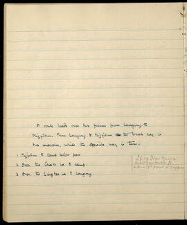
A route leads over two passes from Langong to
Migyitun. From Langong to Migyitun the locals say is
two marches, while the opposite way is three.

1 Migyitun to camp below pass L.p. 178 I have offered an
2 Over the Chato La to camp. award of 100 tankas for
3 Over the Lingtsa La to Langong. either a ♂ Monal or Tragopan.

LSH/1/1/6/1/73 · Part · 1938-06-09
Part of The Ludlow & Sherriff Collection

SUMMARY:
A swollen river and damaged bridge near Lanjong thwart progress, with suspected interference by the ex-gyinpon. The party marches to Trashiyang in wet conditions and arranges with reluctant coolies to attempt a circuit via Tsari Sama. Tsari Sama is noted as a pilgrimage site founded by the lama Giaogama; nothing new was found except an interesting rhododendron.

CONTENT:
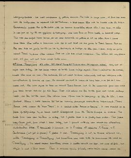
Lanjong people. We had no chance of getting across. The river is huge now, and I don't see even how the bridge can be repaired till the Autumn, and that seems there will be trouble with the Moro and Pachakshiri people. One of the coolies with me knows something about this, I am sure, and thinks it was put up by the ex-gyinpon of Lanjong, who has done us down badly in several ways. This was an awful blow to me, as we were counting on getting a lot up there. Now I have come back three miles and tomorrow will let it out that we are going to Tsari Sama. But as they can stop us going to the Lo La by destroying a bridge, so they can, I fear, stop us going round Tsari by some other means. But we will see what happens. This throws all my plans out, and I am not yet sure what to do now.

13th June To Trashiyang 4 1/2 miles. B.P. 189.3° Temp. 52° Time 4.0pm. Ht. approx. 12809'. Very wet at night and all today. We left camp and came up to the lower bridge again. There I waited for the coolies, and made them come on here. They certainly did not want to come, and obviously had left Lanjong with no intention of coming up here. On arrival we had to have a long talk, and as far as I can make out, they now agree to take me round Tsari Sama, but in the meantime four men have gone back to get rations for six days. That will allow one day to the first rest house, a day's halt, one day to the next, then return here and from here to Lanjong. If they do this, I am content, though I hate leaving the Lo La having arranged everything beforehand. Tsari Sama only means the "New Tsari". It is called either "Sama" or "Sarpa". It was started as a place of pilgrimage by a lama called Giaogama from the Tsübo Gompa in Lhasa. The circle from here can be done in a day, but I gather that is a pretty tall order. This place may prove good, from what I saw today, but I found nothing new except an interesting Rhododendron

LSH/1/1/5/1/42 · Part · 1937-05-06
Part of The Ludlow & Sherriff Collection

SUMMARY:
The page notes a turn up the right bank of the Rindi Chu valley, where the village of Phumzor lies. It also records that Shamgong Dzong is visible below the junction of the Sergang Chu and Mangde Chu on the left bank about half a mile downstream.

CONTENT:
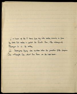
L a turns up the R bank of a big side valley coming in from the West. This valley is called the Rindi Chu, the village of Phumzor is in the valley.

LL Shamgong Dzong can be seen below the junction of the Sergang Chu & Mangde Chu, about 1/2 m down on the Left bank.

LSH/1/1/9/1/124 · Part · 1933-08-25 - 1933-08-26
Part of The Ludlow & Sherriff Collection

SUMMARY:
Heavy rains washed away a bridge to Ritang, forcing a delay at Wangdipotrang and a reroute via Gonte Gompa over a high pass. The Dzongpa met with the party to reorganize plans, and the following day they marched to Kotakha, ascending toward the Pele La amid continued bad weather.

CONTENT:
118

News just come in that we can't go to Ritang. The bridge has been washed away. So this very heavy rain has been general. We will have to wait in Wangdipotrang tomorrow, then go a very long & difficult march over a high pass, go to Gonte Gompa. From there I know the way, but as far as there seems to be very difficult. The number of marches would be the same, but we lose a day in Wangdipotrang.

25th August. Wangdipotrang. Damp & misty. A very short march in here, which we reached 7.0. The Dzongpa came shortly after, & has stayed for over an hour here. He is very worried about the break in the usual route. Like the posts which he described to us last time as being so many - "dashing about here & there every day", this is causing him great trouble, upsetting his quiet way of life. Letters must be sent to cancel the plans & make others, & his whole staff is brought in to work it all out. As far as one can see it should not be the least bit difficult. It will be a change for us to go a different route anyway. Everyone describes the rain as very bad indeed. I suppose Ludlow must have had it too.

26th August. Kotakha. 5 am till 12.30, coolies 2.0. It is certainly a good stiff climb up to the Pele La, which I estimate to be about 10-10

LSH/1/1/3/3/117 · Part · 1933-04-09
Part of The Ludlow & Sherriff Collection

SUMMARY:
Movements are recorded near Lung, with Lumsden and Tenduk exploring a southern valley, Tsongpen a southeastern one, and Pintso reporting a steep climb and descent in the Char Chu gorge; despite a reportedly reasonable route, the party decides to return to Charme via Chayul. Ludlow collects Suthora fulvifrons and rhododendrons, while the diarist notes an early start, a Lopa path possibly leading to Kushung La, and dense mixed forest.

CONTENT:
Lumsden & Tenduk up the valley South of Lung itself. Tsongpen himself up a big valley to the South East of camp. Pintso reports a climb of about 1500 through the gorge of the Char Chu, very steep, & an equally steep descent again. Otherwise the route is supposed to be pretty reasonable, but we have decided to go back to Charme. It seems silly to do so as Charme is 11 miles from here, will take us 8 days going back via Chayul. Ludlow got some Suthora fulvifrons, saw a good many rhododendrons & some other flowers. I had an excellent day, & a long one. Left camp at 5.30 & got in just after 2.0 pm. The first 1300 ft or so was up a burnt hillside, which helped a lot. Then I was lucky in finding a Lopa path through the bamboo. This must I think eventually lead to a pass, perhaps the Kushung La. The jungle is pretty dense, consisting of bamboo & rhododendron, birch, fir, pine & larch. The fir looks like Abies Webbiana again. We found eight more rhododendrons, some of which are particularly fine. The prettiest I thought were Rhod. fulvum 1383 with a nicely spotted upper half, & a blush pink flower: a fine

LSH/1/1/1/1/99 · Part · 1935-07-22
Part of The Ludlow & Sherriff Collection

SUMMARY:
Notes difficulties developing photographic plates due to warm, wet conditions. Describes the march to Tamashu (Totangmachu) from Shukang via forest, Manjibi ridge, and the Begong Chu, with ample water and wood, no leeches, cloudy views, and a note that B. 20 was sent from Lingtsi.

CONTENT:
B. 20 sent from Lingtsi. 24/7
47
the morning developing: bad water & warm. It is almost impossible to dry plates successfully. I fear some are bad. One has to clean the lens every half minute or so, as it becomes fogged with moisture.

(4) 22nd July. TOTANGMACHU (Tamashu of map) 6000' 8 miles. 7600'. Leaving Shukang route ascends gradually to m 2, where a chorten stands in the path & a saddle is crossed. Path then enters thick forest, & descends easily to m 3 1/2 where a second chorten is passed. The hillside then becomes more open & thick forest is left behind. The path, which is good the whole way descends to a side valley which is crossed at m 5. After this the hillside is wooded with pines (P. longifolia). The route ascends from this valley, crosses a ridge at 5 1/2 (MANJIBI) & drops fairly steeply, through cultivated land to the BEGONG CHU, which is crossed by a bridge at m 7. The ascent of the N. side is steep at first then easy over a bare hillside to a saddle at m 8. Tamashu lies just mile beyond the saddle. Water & wood ample: no leeches. A few houses at the saddle are called TAKYELA.

B. 20 funked. Views on march to Tamashu: cloud.

B.