•Letter to W.H. Campbell form Rollo (8 April 1840)
Rollo, Hon. RSUMMARY:
The writer explains the origin of the Cha La pass name and describes camping in the steep Rong Chu valley, planning to stay to collect flowers and arranging a local to watch bags until a man from Trashiyangsi can retrieve them in October. The mail finally arrived after 20 days via Mago, Dirang Dzong, Poshnig, and the Tse Las; the carriers were fed, paid 20/- each, and sent off.
CONTENT:
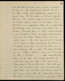
Over the Cho La he came here, and when he reached the Cha La, the people of the District all met him there, with hands supplicating, begged him to remain here. For this reason is the pass called the 'Cha La'—Cha meaning 'hand' in honorific Tibetan. He however refused, and went on to Lhasa.
The Rong Chu is a magnificent valley. It is steep-sided, the north face being covered for some height with conifers. The south face, on which we are camped, is very precipitous indeed, and grass and rock covered where not too steep. Flowers abound, but are mostly over. We will stay tomorrow to enable us to make a better examination for flowers, and to enable me to 'bag' some of the better ones. I have arranged with a local to watch the bags for me until I send a man from Trashiyangsi for them in October.
Last night the mail came in at last. As we had expected, the mail had gone to Mago by the lowest route, Dirang Dzong, Poshnig and Tse Las. They had, poor men, been 20 days on the way with very little food indeed. We fed them well though, paid them 20/- each, and sent them off happy this morning.
Everything in the bag was distinctly wet, which

SUMMARY:
Notes describe steep cliffs and riverside vegetation along the Rong Chu, including willow, juniper, rhododendron scrub, birch, and currant/gooseberry, with firs on the right bank. An entry for Aug. 21st references Cho La as a high, easy pass (~16,150') with nearby glaciers, forested slopes of fir and rhododendron, and views toward a glaciered range overlooking the Yombu Chu.
CONTENT:
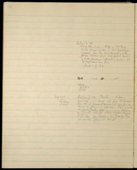
Ludlow p. 98.
Rong Chu river, cliff on left bank.
towered straight up above us to a great height.
vegetation near the river consisting of willow,
Juniper, Rhodo. scrub with quite a number
of birch & currant or gooseberry bushes. On
the right bank were firs.
Beris - p. 99
186.8 Temp. 53° = 1.05
13676
68380
14360'
Aug. 21st Ludlow p 100. Cho La. - the pass -
next page 16,150' high is a large easy pass. To the west
S. Basin were several peaks of considerable size from which
descended numerous glaciers. View to south
very pretty, valley slopes commencing below us
were forested with fir & rhod. whilst beyond
to the S.W. overlooking the Yombu Chu
was another glaciered range.
SUMMARY:
Page lists Primula and other plant specimens with numbers. The 'ROOTS COLLECTED' section records species with day-month dates in September and October, notes such as 'NOT TO BE DIVIDED' and 'ONLY TWO PLANTS', and that Sorbus ursina seed was eaten by caterpillars.
CONTENT:
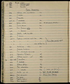
19836 Primula uniflora.
(2) 19835 " tsariensis (alba).
(3) 19832 " umbratilis (alba).
19842 " tsariensis.
ROOTS COLLECTED.
19309 Androsace white, large cushions. 13.9.
19330 P. Waddellii. 9.9.
19167 P. tenuiloba
19750 (2) P. macrophylla. 16.9.
19235 Sorbus ursina. 19.9. All seed eaten by caterpillars.
19757 Primula strumosa 20.9.
19226 Prim. Caveana white. 21.9
19766 " Caveana. "
19764 Alardia woolly blue violet. "
19767 P. concinna. "
19768 A P. Calderiana x strumosa hybrid blue 22.9 }
B " " " " " } To one place, see for report.
C " " white with dark eye " }
19771 Aconitum sp. v fine. 23.9.
19146 Diapensia himalaica "
19712 Prim. macrophylla v macrocarpa "
19123 Cypripedium tibeticum. 25.9.
19366 Androsace small 4" pink 26/9.
2 19777 = 19378 P. jonardunii. 27/9
19373 P. Waddellii. "
19404 Androsace globifera. 28/9.
19420 Prim. sonchifolia. 29/9.
19128 " umbratilis 30/9 (number not put on).
19716 Alardia wine red. 1/10. NOT TO BE DIVIDED.
19721 Gent. aff amoena 1/10 ONLY TWO PLANTS
- Prim. pusilla 3/10
19544 Thalictrum chelidonii. 13/10
19574 Prim. flagellaris. 16/10
2x photo albums, including Ross's retirement party; 4x loose prints, inc. Della Purves, Mycology/Pteridology Lab at RBGE, 26 May 1972, view of the Glasshouse Range, 18 June 1968; purple flower - pulsatilla vulgaris?; 3x 8mm (super 8) films relating to RBGE - 'Loch Eck', 'RBGE' and 'RBG Yashika, 77'; also Funeral service and eulogy.
Eudall, RossSUMMARY:
The diary describes following the Mara Chu, crossing small side streams and ridges, and reaching a camp at mile 8. It notes the village of Adao, whose inhabitants move to Phobjikha during the rains and occasionally return to tend crops, with some fever present. Observations include abundant R. Maddenii/R. Edgeworthii and a fine forest of Pinus longifolia opposite Adao.
CONTENT:
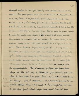
absolutely solidly the rest of the evening - real Bhutan rain at its very
best. The path follows what is here known as the Mara Chu, the
whole way down. It is good most of the way, sometimes sunken.
At m 3 a big side valley from the R is crossed, then the path
ascends easily to m 4 1/2 the highest point reached. Up till here there
is some cultivation. Then an easy, though steep in places, descent
to near the main river again to 6 level to 6 1/2 where another
sidestream is crossed. Both are small. The main valley is here
narrow and steep sided, the path ascends to a ridge, crossed at
m 7. Thence descent begins easily at first to m 8 camp.
The Mara Chu here must fall very rapidly indeed, and both sides
of the valley are very steep and precipitous. About 1 m further
on a valley enters from the Right on the L bank of the
Mara Chu, above m 11 is ADAO a biggish village with
lots of cultivation. The inhabitants of Adao all leave their
village at this time and go to Phobjikha, just returning every now
and then to look after their crops. There is some fever in Adao during
the rains. / Here R. Maddenii or R. Edgeworthii are very common
indeed. Opposite Adao I see forest of Pinus longifolia, and it looks
a very fine forest indeed, bigger than any I have yet seen,
SUMMARY:
Wet morning clearing to a fine evening; the route follows the Tangchu, passes a mani and the village of Chubana, then climbs steeply through forest to huts below a ridge. Botanical notes include Meconopsis villosa common from 11,500 to 13,000 ft, Androsace rhizomatosa var. major common, and Primula lesteri (No. 3192) observed near mile 9.
CONTENT:
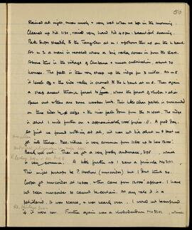
Rained all night, was misty & very wet when we left in the morning. Cleared up till 11:30, rained very hard till 4:00 pm. Beautiful evening.
Path drops steadily to the Tangchu at m 1 & follows this up on the L bank. At m 2 a mani is reached where a big valley comes in from the East. Above this is the village of Chubana & much cultivation, about 70 houses. The path is then very steep up the ridge for 3 miles. At m 5 it levels off & the side valley is crossed to the L bank at m 6. Then again a steep ascent through forest to where the forest of rhodo. & abies opens out & there are some wooden huts. This little clear patch is surrounded on three sides by cliffs & the river falls down from the N West. The ridge is about 1 mile further on & approximately 1000' higher. // A good day.
At first we found nothing at all, & it was not till about m 9 that we got into things. Meconopsis villosa is very common from 11,500 up to here 13,000'. Barely yet out. Then we got a very pretty Androsace (3195: Androsace rhizomatosa var. major), which is very common. A little further up I saw a Primula No. 3192 (P. lesteri 3192 - see Aug 8). This might
SUMMARY:
Notes a method to store green seeds using a CO2-filled soda syphon bottle and describes dramatic cliffed terrain with poor flowering. Describes friendly local yak herders resembling Takpas and details the path along the Tulung Chu with numerous river crossings to Dyuri (opposite Nyuri), correcting the map location of very hot springs to the left bank above Dyuri.
CONTENT:
its seeds green, so they will be put in a bottle of the soda syphon, empty of water, but full of CO2 squirted into the bottle. When it cleared up today, we got rather a surprise. Instead of the plain we expected here, we found sheer cliffs everywhere, rising to 2000 or 4000 ft from the valley bed - a fine sight. But flowers poor. The locals are nice people, out to please. They are more like Takpas than Tibetans, wear the pressed felt hat, but with 10 or 12 drip tips instead of the Takpas four or so. They have no fields here and no food of their own is grown here. They are purely yak herds, exchange their milk and yak produce for grain from down the valley near Tawang.
Path crosses the side stream by a bridge at camp and so down the R. bank of the Tulung Chu. Thence crosses the main river twice before Chuna. After Chuna the river is crossed for 8 times. Path first over open hillside, then through jungle, finishing on the L bank where Dyuri is situated at m 8. Nyuri is exactly opposite. The sides of the valley are extremely precipitous. The hot springs (half a mile above Dyuri) marked on the map should be on the left bank, not the R. as shown. Both banks. The water is too hot to hold the hand in, where it
SUMMARY:
Notes describe travel from Singo Samba along the left bank through fir forest, with crossings of the Lanyong Chu, open yak-grazing areas, and a camp on a slope. Botanical observations include several Primula species in Singo Samba and the Lanyong Chu Valley, with a query about a yellow form from east of Brumban, and mention of a route from Lanyong to an upper bridge.
CONTENT:
29a
From Singo Samba, continue up the L bank on aft bearing of 230° for 1 mile; river then bends again to 345°. Path up stream in fir forest, with a few clearings every now and then. Thin cliffs on the right hand side. Fit for yaks grazing.
2675 Continue up valley for 6 miles to pick hub, on L bank. Cross Lanyong Chu at m 1½, return at m 3. Valley has many open spaces, used by yaks as summer grazing ground. Camp on slope. Good. Line of valley approx 260° M.
-
Primula prenantha. Singo Samba. Very common.
-
Primula wattii. Lanyong Chu Valley. Growing in great quantity, covering whole swamps. Does the yellow form from E. of Brumban?
-
Primula wessa. Lanyong Chu Valley. This again is not at all like the type 2514. It seems to be much more like P. nivalis, or like no 2189. (Nipa?). But it is not yet fully out.
-
Primula hookeri. Lanyong Chu Valley. An odd plant. It was low, but on a valley bank, presumably brought down by the stream.
From Lanyong to upper bridge 10 miles, down L bank, the first four miles at the same bearing as
SUMMARY:
The page details travel along elephant tracks with difficult forest terrain, scarce water points, heavy leeches and flies, and coolies starting at 6:15 and arriving by 3:00 pm. On 27 April at Camp Galam in the Gale Chu valley, a 6-mile descent crosses a small nala and then the main Gale Chu, with notes on weather and river conditions.
CONTENT:
7
no proper path beyond this, but an elephant track leads straight along up this ridge, to m 6 where there is a small pool of bad water, used by elephants. Thence turn left handed & descend by elephant path through dense forest. At about m 7 1/2 a small side nala is reached, which contains good water most of the year round. A bad camp site, but the only place water is available. Leeches & dam-dum flies very bad indeed. Coolies started at 6.15, were in at 3.0 pm. These are poor coolies, who seem to have a good deal of fever, but the ascent is both hot & steep. Elephants must be very common indeed. Picked up one feather of the peacock pheasant, which are said to be common.
27th April. Camp Galam. (Gale Chu valley). 6 miles.
BP. 203.0° Temp. 71° Time 3.0 pm. Rained a good deal last night, but has been fine all day today. Path continues descent which is easy, through dense forest, following elephant path, to m 1 1/2 where a small nala is crossed. At m 2 the main Gale Chu is reached & crossed. It is a small river just now, easily