Showing 6828 results

Archivistische beschrijving
2091 results with digital objects Show results with digital objects
LSH/1/1/2/1/135 · Part · 1933-07-18
Part of The Ludlow & Sherriff Collection

SUMMARY:
The writer explains the origin of the Cha La pass name and describes camping in the steep Rong Chu valley, planning to stay to collect flowers and arranging a local to watch bags until a man from Trashiyangsi can retrieve them in October. The mail finally arrived after 20 days via Mago, Dirang Dzong, Poshnig, and the Tse Las; the carriers were fed, paid 20/- each, and sent off.

CONTENT:
Over the Cho La he came here, and when he reached the Cha La, the people of the District all met him there, with hands supplicating, begged him to remain here. For this reason is the pass called the 'Cha La'—Cha meaning 'hand' in honorific Tibetan. He however refused, and went on to Lhasa.

The Rong Chu is a magnificent valley. It is steep-sided, the north face being covered for some height with conifers. The south face, on which we are camped, is very precipitous indeed, and grass and rock covered where not too steep. Flowers abound, but are mostly over. We will stay tomorrow to enable us to make a better examination for flowers, and to enable me to 'bag' some of the better ones. I have arranged with a local to watch the bags for me until I send a man from Trashiyangsi for them in October.

Last night the mail came in at last. As we had expected, the mail had gone to Mago by the lowest route, Dirang Dzong, Poshnig and Tse Las. They had, poor men, been 20 days on the way with very little food indeed. We fed them well though, paid them 20/- each, and sent them off happy this morning.

Everything in the bag was distinctly wet, which

LSH/1/1/2/1/137 · Part · 1933-07-18
Part of The Ludlow & Sherriff Collection

SUMMARY:
Camped on a steep slope near Chukar, the party finds the location friendlier than Mago or Tsena though lacking level ground. On a halt day, the writer went with Danang to nearby cliffs to collect primulas and delphinium, noted Thalictrum of Mago and the Tulung La Meconopsis, and arranged for a local man to care for specimens with plans to retrieve them from Trashiyangsi in October.

CONTENT:
67

is hardly surprising however. Our yak men are a deformed looking lot, but cheerful enough. Everyone here is pleasanter than in either Mago or in Tsena. I wish we had known of this place before. I'm sure it would have proved of great interest a month or more earlier. There is barely room for tents here, we are all on a horrible slope. If it rains hard, we will undoubtedly be washed out of our tents. But there is no level ground anywhere near. Probably a better camp would be beside the river, but in fact we did not go down so low, as I would have had a hard climb tomorrow.

19th August. Halt at Chukar. In the morning I went with Danang up to the cliffs, wandered about them hoping to find more than the three primulas of yesterday, but got nothing new. Bagged 16 of the new primula & 6 of the blue one. Also this evening bagged 6 delphinium. A local man is to look after them, & I will send a man from Trashiyangsi in October to retrieve the lot. I hope the scheme works. The pretty Thalictrum of Mago is growing here too & the Tulung La Meconopsis. Quite a good day on the whole, but

Blank lined notebook page
LSH/1/1/2/1/138 · Part · 1933-07-18
Part of The Ludlow & Sherriff Collection

SUMMARY:
This page appears to be blank with no legible text to extract.

CONTENT:
The image provided is a blank page from a lined notebook. There is no legible text to extract.

LSH/1/1/2/1/139 · Part · 1933-07-18
Part of The Ludlow & Sherriff Collection
  • SUMMARY:
    The writer discusses limited views of the main range, suggesting Cho La is on the main range and that the area between it and the pass may belong to Bhutan; they note it is the transition zone they sought and should have visited instead of Mago, with similar zones at Shao and north of Tulung La. They record altitude preferences, expecting Plumbago lower along the Nyamjang Chu, and note Primula eburnea along the Cho La cliffs north of the Rung Chu at a lower elevation than at Narim Thang.

CONTENT:
68

never completely clear. In fact all we have been allowed
to see of the main range to the south is an occasional
glimpse of glacier here and there. I think there can be
no doubt that the Cho La is on the main range,
in that case the area between the Cho and the La
should belong to Bhutan. Last year no one knew
where it was, and the Maharaja was anxious to find
out to whom it should belong. This is an area
we should have visited instead of Mago. It is the
transition zone we have been looking for all along,
but which we failed to find. A similar zone
almost certainly exists at Shao, but we had no
time there. N. of the Tulung La also there must
be such a place, but we were then always too
high, our camps being over 15000 ft. For this
zone the best heights would appear to be between
10000 ft and 14500 - 15000'. Here we are too high
Plumbago NB

  • for the Plumbago so much wanted, but I have no
    doubt it grows at 11500 or so down the Nyamjang
    P. eburnea
  • Chu. Primula eburnea grows all along the
    cliff side of the Cho La to the north of the
    Rung Chu, under overhanging cliffs, as does P.
    P. lilledale
  • No 847. It is curious that it grows at
    1000 ft lower here than at Narim Thang. I
LSH/1/1/2/1/140 · Part · 1933-07-18
Part of The Ludlow & Sherriff Collection

SUMMARY:
Notes describe steep cliffs and riverside vegetation along the Rong Chu, including willow, juniper, rhododendron scrub, birch, and currant/gooseberry, with firs on the right bank. An entry for Aug. 21st references Cho La as a high, easy pass (~16,150') with nearby glaciers, forested slopes of fir and rhododendron, and views toward a glaciered range overlooking the Yombu Chu.

CONTENT:
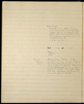
Ludlow p. 98.
Rong Chu river, cliff on left bank.
towered straight up above us to a great height.
vegetation near the river consisting of willow,
Juniper, Rhodo. scrub with quite a number
of birch & currant or gooseberry bushes. On
the right bank were firs.
Beris - p. 99

186.8 Temp. 53° = 1.05
13676
68380
14360'

Aug. 21st Ludlow p 100. Cho La. - the pass -
next page 16,150' high is a large easy pass. To the west
S. Basin were several peaks of considerable size from which
descended numerous glaciers. View to south
very pretty, valley slopes commencing below us
were forested with fir & rhod. whilst beyond
to the S.W. overlooking the Yombu Chu
was another glaciered range.

LSH/1/1/2/1/141 · Part · 1933-07-18
Part of The Ludlow & Sherriff Collection

SUMMARY:
The diarist camps on the north side of Cho La, describing the route along the Rong Chu and then the Re Chu with several crossings, noting a good camp at Re before the final ascent and giving bearings and distances. A partridge was shot earlier, and both Kuntip and Puitu are reported to be feeling better.

CONTENT:
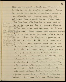
69

think we will almost certainly find it all about
the Cho La if the situation is suitable. Finished
the evening by shooting a partridge - again a
very interesting bird from a place like this.

  • about 2000ft for Seamus.

20th August. Camp N side of CHO LA. 5 miles. 14360'.
Path drops down to the Rong Chu, a river nearly as
big as the Myangchu Chu in summer. Follow up
the left bank under steep bare cliffs. The R bank
less steep & thickly wooded with deciduous & conifers.
At m 1½ cross by a food bridge to the R bank &
at m 2 leave the Rong Chu - follow up the
Re Chu due South. The Re Chu is crossed at m
to the L bank & recrossed further up. A good
CG at m 4.5 at Re, before the final ascent
to the Cho La. Water & grazing good & fuel ample.
Bearing of Re to the mouth of the Re Chu is
50° Mag. & from Re to the Cho La 215° Mag. Distances
between should be approx equal, the pass being perhaps
a little closer. The Rong Chu is a fine valley
with magnificent cliffs on its north side. The south
too is nice, thickly wooded. A week in the
valley would certainly produce some good birds
& possibly flowers too. Kuntip is better this
evening. He & even Puitu were

LSH/1/1/2/1/142 · Part · 1933-07-18
Part of The Ludlow & Sherriff Collection

SUMMARY:
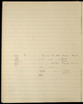
Notes record barometric pressure and temperature observations at Cho La, including means and elevation calculations (e.g., 15382 x 1.05 = 16151; 12377 x 1.05 = 12995').

CONTENT:
14698 57 Cho La. B.P. 183.8° Temp 52 Mean 54.0
570 --- 15382 x 1.05 = 16151
114 114
----- B.P. 189.1 Temp 55 Mean 54
15382
769.10 12377 x 1.05
----- 618.85 = 12995'
16151 12995

LSH/1/1/2/1/143 · Part · 1933-07-18
Part of The Ludlow & Sherriff Collection

SUMMARY:
Notes an incident where Kurtip was thought to be under a 'mantra' by Tawang people after a dispute, and remarks on the Tulung La tree. Describes the route from Re over the steep Cho La to Karmu via Mena, following the Mena Chu through forested terrain.

CONTENT:
very bad, had come to the conclusion that it was
not an illness, but that Kurtip had had some
'mantra' put on him by the Tawang people because
he beat them up a bit when they failed to get a
move on between Muktur & Tawang. Noticed
the small Tulung La tree here again. It must
grow all along these hills, but only or mostly in
the main range.

21st August. Camp at KARMU. 8 miles. 12995'. (B.P of
Cho La 183.8 Temp 52° = 16151' BP of Karmu 189.1 Temp
55° = 12295'.). After leaving the thang at Re,
path ascends steeply to the south keeping to the left bank
of the stream. At m 1 a small plateau is reached.
The final ascent to the CHO LA at m 2 is very steep
indeed. The pass itself is an absolute knife edge,
steeper on the north than the south. Descent over
bare hillside to the south into a beautiful valley,
thickly fir clad on the north north west face. A
river is met at m 3 1/2 & followed down being
crossed occasionally. At m 5 a plain is reached,
called Mena, where there are usually yak herds. The
Mena Chu is followed down first over open country,
then through thick forest. The path keeps up the
R bank after m 5 & is more or less level to